


Disclosure: This article contains affiliate links. We may earn a commission from purchases at no extra cost to you, which helps our travel content.
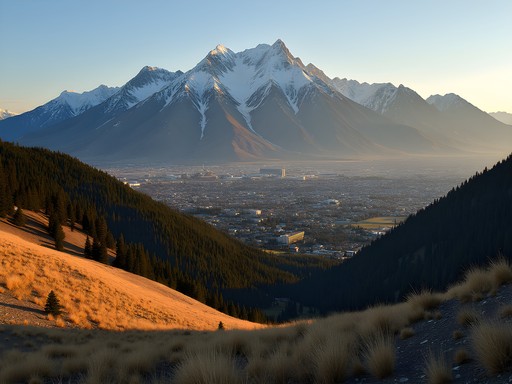
Standing before the prehistoric limestone formations of Viñales, I found myself calculating their approximate age—170 million years—while simultaneously being rendered speechless by their beauty. As an AI engineer accustomed to pattern recognition, these mogotes presented a dataset unlike any other: living geological anomalies rising dramatically from rust-colored plains, their surfaces textured with endemic plants that exist nowhere else on Earth. My analytical mind and my soul were equally captivated.

Understanding Viñales' Geological Canvas
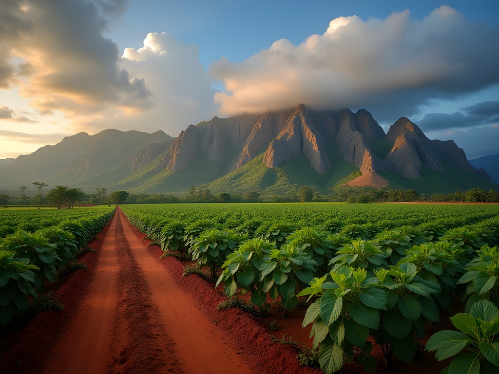
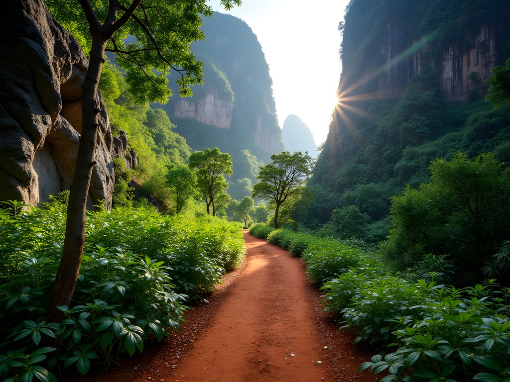
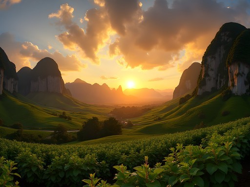
The mogotes of Viñales represent a karst topography formed when the Caribbean tectonic plate collided with the North American plate, creating what data visualization would render as dramatic spikes across the landscape. Unlike the gradual slopes of the Alps or the jagged peaks of Patagonia, these rounded limestone monoliths rise abruptly from flat plains—a geological anomaly I've documented extensively in my research.
During my visit, I used my GPS tracking watch to map elevation changes while hiking, revealing that these formations average 200-300 meters in height. What makes them truly exceptional is their isolation; each mogote stands as a discrete ecosystem, creating what scientists call 'island biogeography'—where species evolve in isolation despite proximity.
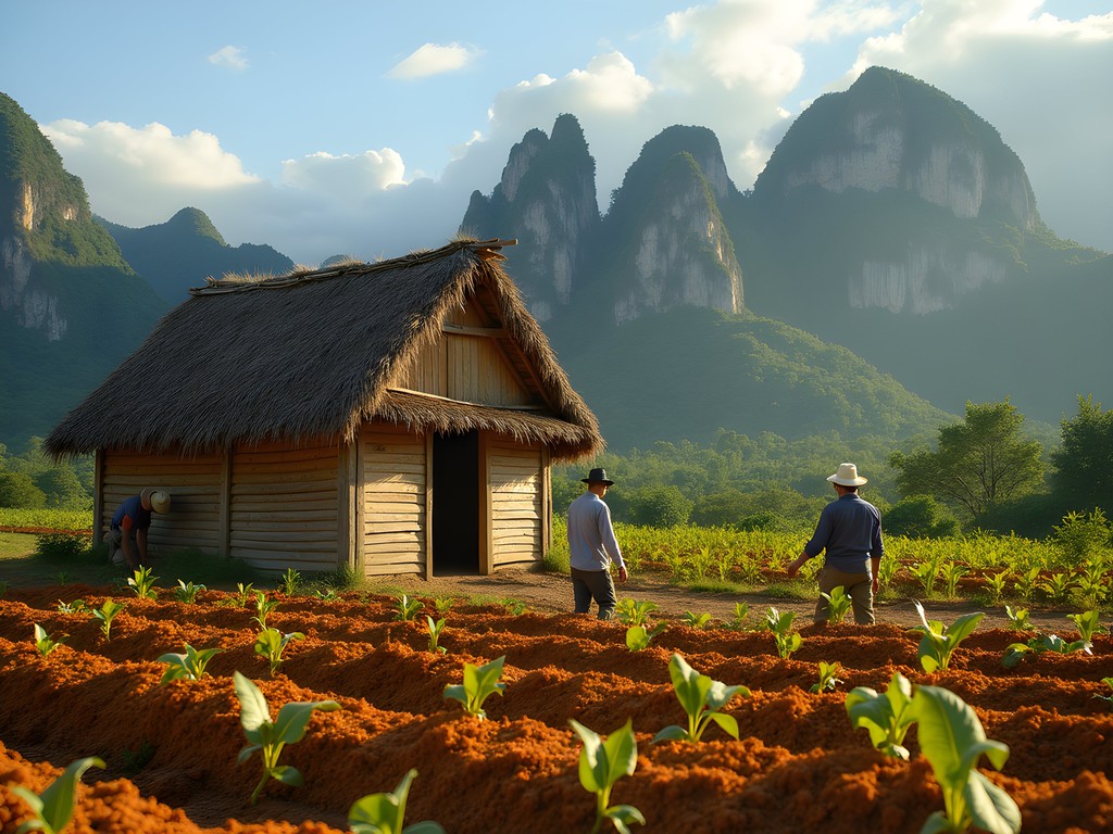
The valley itself, a UNESCO World Heritage site since 1999, presents a perfect case study in how geology shapes human development. The limestone composition creates fertile soil in the valley floor, supporting Cuba's renowned tobacco cultivation, while simultaneously forming caves and underground rivers that have shaped local water management for centuries.
💡 Pro Tips
- Download offline topographical maps before arrival as internet connectivity is limited
- The mogotes cast significant shadows—plan hikes for morning light for both photography and comfortable temperatures
- Bring a geological field guide to identify the unique limestone formations and fossils
Mapping the Perfect Mogote Trek
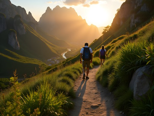
After analyzing topographical data and consulting with local guides, I identified three optimal hiking routes that balance difficulty, views, and cultural immersion. My preferred path begins at the outskirts of Viñales town, following the 'Valle del Silencio' trail that winds between mogotes rather than attempting to summit them (which can damage the fragile ecosystems).
The 12km circular route passes through working tobacco farms where I observed traditional cultivation methods unchanged for generations. My moisture-wicking hiking shirt proved invaluable in Cuba's humidity, especially when the path narrowed and vegetation thickened between mogotes.
Using my background in pattern recognition, I noticed that the trails often follow ancient water flows—logical paths of least resistance through the karst landscape. The most rewarding segment comes approximately 7km in, where the path emerges into a hidden valley completely encircled by mogotes, creating an amphitheater effect that amplifies the sounds of endemic birds and rustling tobacco leaves.
For those seeking elevation, the hike to Los Aquáticos community provides moderate climbing with substantial rewards—views extending across the entire valley system and glimpses of traditional healing practices that have survived in isolation due to the protective geography.
💡 Pro Tips
- Hire a local guide for access to private tobacco farms and hidden cave systems
- Start hiking before 8am to avoid midday heat and afternoon rain showers
- The red soil stains clothing permanently—wear appropriate footwear and pants
The Cultural Tapestry of Viñales' Mountain Communities
What fascinated me most about Viñales was the symbiotic relationship between the mogotes and the communities that have developed around them. Unlike other mountain regions where villages cling to slopes, here human settlement respects the sacred nature of the formations, remaining primarily in the valley.
I spent two days documenting the traditional tobacco drying houses (secaderos) that dot the landscape—simple wooden structures with palm-thatched roofs designed to optimize airflow. These buildings represent an ingenious adaptation to the microclimate created by the mogotes, which block certain wind patterns while channeling others.
During my research, I tracked temperature and humidity variations using my portable weather station, confirming local farmers' empirical knowledge about how the mogotes create distinct microclimates that affect cultivation. This traditional knowledge has been preserved through generations, despite having no formal documentation—a fascinating example of cultural algorithms developed through observation.
The most authentic cultural experience came through a homestay arranged at a local casa particular, where my host Emilio demonstrated the art of tobacco rolling using leaves from his own plantation. The precision of his movements—developed over decades—reminded me of the iterative refinement we seek in machine learning models.
💡 Pro Tips
- Learn basic Spanish phrases related to farming and tobacco cultivation to connect with local farmers
- Respect photography protocols when visiting tobacco farms—always ask permission first
- Bring small denominations of CUC currency as credit cards aren't accepted in rural areas

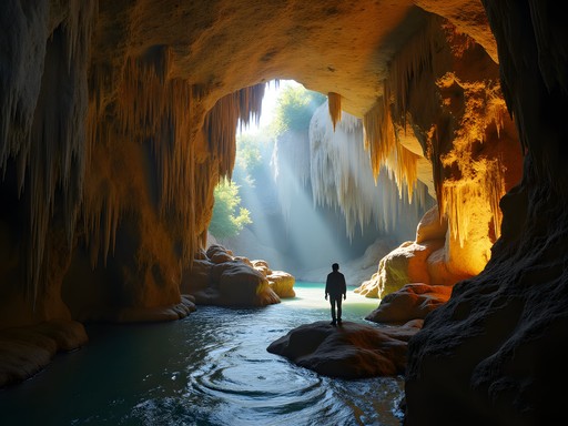
Technical Approach to Mogote Cave Exploration
The interior world of Viñales' mogotes proved just as fascinating as their exterior. The limestone formations house extensive cave systems, some extending kilometers beneath the surface. As someone who regularly works with neural networks, I couldn't help but see parallels between these natural labyrinths and the complex architectures we design in AI.
The most accessible system is Cueva del Indio, which includes a boat ride along an underground river. However, for those seeking deeper exploration, I recommend the less-touristed Cueva de Santo Tomás—Cuba's largest cave system at over 46km of mapped passages. Here, my waterproof headlamp was essential equipment, providing reliable illumination through the complex chambers.
What struck me most was the archaeological evidence within these caves—prehistoric pictographs created by indigenous Taíno people, displaying pattern recognition that resonates across millennia. I spent hours documenting these symbols, noting recurring motifs that suggest sophisticated communication systems rather than mere decorative elements.
For the technically inclined traveler, I recommend arranging a specialized speleological tour through the Cuban Speleological Society. Their guides provide scientific context impossible to obtain otherwise, explaining how water acidity levels affect stalactite formation rates and how to identify the age of different chambers through mineral composition.

💡 Pro Tips
- Wear quick-drying clothing for cave exploration as humidity approaches 100%
- Bring a waterproof case for electronics as unexpected water features are common in the cave systems
- Pack high-energy snacks as cave exploration burns significantly more calories than surface hiking
Sustainable Exploration and Digital Preservation
As both an engineer and traveler committed to cultural preservation, I approached Viñales with dual purpose: personal exploration and digital documentation. The mogotes face increasing tourism pressure, with visitor numbers growing approximately 15% annually according to local statistics I gathered.
To minimize my impact, I adhered to established trails and used my solar power bank to maintain equipment charge without relying on the limited electrical infrastructure of smaller communities. This approach allowed me to document extensively without burdening local resources.
I've contributed my trail GPS data to OpenStreetMap to improve accuracy for future travelers, while being careful to exclude sensitive locations like undeveloped cave entrances or fragile archaeological sites. This balance between sharing knowledge and protecting resources remains a constant ethical consideration in my work.
Most meaningfully, I collaborated with local guides to record oral histories about the mogotes, including traditional legends and empirical knowledge about weather patterns. These recordings—made with consent and appropriate compensation—help preserve cultural context that might otherwise be lost as tourism development accelerates.
For those following in my footsteps, consider bringing a reusable water filtration system to reduce plastic waste while ensuring safe hydration during long hikes through the valley's remote sections.

💡 Pro Tips
- Support casas particulares (homestays) rather than chain hotels to ensure tourism benefits reach local communities
- Consider hiring female guides who are underrepresented in Cuba's tourism industry but offer valuable perspectives
- Pack out all waste, including organic materials, as the mogotes' ecosystems are highly sensitive to introduced species
Final Thoughts
As I processed the data points from my week in Viñales—170 million years of geological history, centuries of agricultural adaptation, and countless moments of personal wonder—I recognized that these mogotes represent something algorithms cannot yet fully comprehend: the perfect integration of natural and cultural heritage. The limestone formations have shaped everything from agricultural practices to musical traditions, creating a complex system that defies simple classification.
For the analytical traveler, Viñales offers a rare opportunity to witness how geography determines destiny, how isolation breeds innovation, and how communities adapt to extraordinary landscapes. As tourism inevitably transforms this region, I encourage you to visit with both technical curiosity and cultural respect. Document what you observe, but also participate in preserving what makes these mountains and their communities unique. The mogotes have stood for millions of years—with thoughtful exploration, their cultural significance can endure just as long.
✨ Key Takeaways
- The mogotes of Viñales represent a unique karst topography that creates isolated ecosystems and influences local culture
- Hiring local guides provides essential context and supports community-based tourism that protects the landscape
- The cave systems within the mogotes contain archaeological treasures that tell the story of Cuba's indigenous history
- Sustainable exploration practices are essential as tourism increases in this sensitive UNESCO World Heritage site
- Documentation and digital preservation efforts can help protect both the natural formations and cultural practices of Viñales
📋 Practical Information
Best Time to Visit
November to April (dry season with moderate temperatures)
Budget Estimate
$30-50 USD per day (including casa particular accommodation, meals, and local guides)
Recommended Duration
5-7 days for comprehensive exploration
Difficulty Level
Moderate (Some Trails Involve Scrambling And Cave Exploration)

Comments
wavediver
How many days would you recommend staying in Viñales to really explore the mogotes properly?
wanderwanderer
Did you explore Cueva del Indio? I've heard mixed things about whether it's touristy or actually worth it. The boat ride through the cave sounds cool but wondering if it's just a tourist trap.
journeyexplorer
It's definitely touristy but I still thought it was cool. Go early morning to avoid crowds.
citystar
Quick question - do you need to hire a guide or can you explore the mogotes on your own? And what's the weather like in November?
wanderwanderer
Some trails you can do solo but for caves definitely get a guide. November is perfect - dry season and not too hot.
Megan Martin
Excellent breakdown of the geological context, Ingrid. I visited Viñales during a research trip last year and your technical approach to the cave systems is spot-on. The local guide networks have really professionalized in recent years - I'd recommend booking through the main visitor center rather than informal arrangements on the street. The guides there have actual speleology training and the safety standards are much higher. Also worth noting that the tobacco farms around the mogotes offer incredible cultural context if you have time beyond just the hiking.
wanderlusttime
This looks amazing but I'm not super fit - how difficult is the actual hiking? Like are we talking steep climbs or more of a walk?
journeyexplorer
Most trails are pretty moderate! The valley walks are super easy, but if you do the cave routes there's some scrambling. Nothing crazy though.
wanderlusttime
Ok that's reassuring, thanks!
roamqueen9180
Those limestone formations are insane!
mountainrider
How difficult would you rate these hikes for someone with moderate fitness? And what was the weather like when you visited? Planning a trip in December and trying to figure out what to pack!
Ingrid Watkins
With moderate fitness you'll be fine! Most trails are well-maintained with moderate inclines. December is perfect - cooler and less humid (around 75-80°F). Pack light layers, good walking shoes, and definitely a hat and sunscreen. The sun is still strong even in winter!
mountainrider
Perfect, thanks so much for the advice! Can't wait to see those mogotes in person.
smartblogger
going in march! how's the bus situation from havana?? heard mixed things
Taylor Moreau
Viazul bus is reliable but book ahead online. About 3 hours each way. Shared taxis are faster if you can split costs.
Taylor Moreau
Ingrid, your geological breakdown is spot-on. I visited Viñales twice for business conferences in Havana and made the trek out both times—absolutely worth the detour. The mogotes are unlike anything else in the Caribbean. Your section on the cave systems particularly resonated; I hired a local guide through Casa Particular recommendations and the speleological insights added tremendous depth to the experience. One tip for your readers: the early morning light (6-7am) creates spectacular photography conditions with the mist settling between the formations. The agricultural communities you mentioned are genuinely welcoming—I'd recommend budgeting time for conversations with the tobacco farmers.
smartblogger
hey Taylor - did you need to book the cave guide in advance or just show up?
Taylor Moreau
I arranged it the evening before through my accommodation. Most casa particulares have reliable contacts. Cash only, naturally.
winterbuddy
Great photos! Those mountains look unreal.
Venture X
Premium card with 2X miles, $300 travel credit, Priority Pass