


Disclosure: This article contains affiliate links. We may earn a commission from purchases at no extra cost to you, which helps our travel content.
There's something magical about Maine that goes beyond the postcard-perfect coastline most travelers flock to. As someone who's summited peaks across three continents, I've developed a particular fondness for the underrated mountain trails surrounding Auburn. This central Maine gem offers the perfect weekend escape with terrain that challenges your hiking abilities while rewarding you with spectacular fall foliage that rivals anything I've seen in my travels through the Swiss Alps or New Zealand's South Island. Grab your boots—we're heading to the hidden peaks that locals would prefer to keep secret.

Mount Apatite: The Geological Wonder
My first encounter with Mount Apatite came during an impromptu detour while driving between renewable energy sites three years ago. What began as a quick stretch break turned into a fascinating four-hour exploration. Despite its modest 400-foot elevation, Mount Apatite packs remarkable geological diversity into its network of trails.
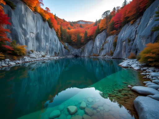
The 325-acre park features abandoned quarries where amateur geologists and curious hikers can still discover quartz, feldspar, and the namesake apatite crystals. The main loop (2.7 miles) offers a perfect introduction with gentle grades and well-marked paths. For those seeking more technical terrain, the northern quarry trails provide steeper climbs over loose rock that demand proper footwear.
During my fall visits, I've found the western slopes particularly stunning around 4 PM when the setting sun illuminates the changing maple leaves. The quarry pools reflect the fiery canopy, creating natural mirrors that have filled my camera roll more times than I'd like to admit. For safety on these sometimes slippery trails, I always bring my trekking poles, which have saved my ankles countless times on the quarry's uneven terrain.

💡 Pro Tips
- Visit on weekdays to avoid the weekend gem hunters
- Pack a small rock hammer if you want to collect specimens (legally allowed in designated areas)
- The northern trails can be slippery after rain—bring appropriate footwear
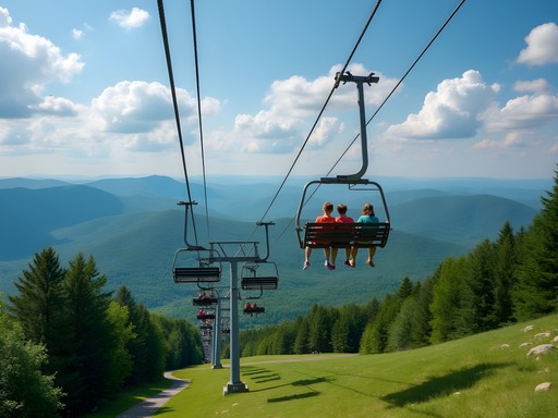
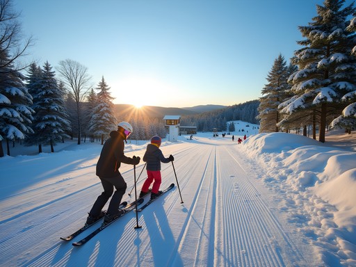
Lost Valley: Perfect for Progressive Skill Building
Lost Valley holds a special place in my hiking rotation because of its versatility. While many know it as a ski area in winter, autumn transforms it into a hiker's paradise with trails for every ability level. What makes this 200-acre area unique is how deliberately the trails progress in difficulty, allowing you to build skills within a single location.
I typically start clients or visiting friends on the Valley View Trail (1.1 miles), which offers a gentle introduction with grades rarely exceeding 5%. For intermediate hikers, the Ridge Run (2.3 miles) delivers more challenging terrain with several technical rock scrambles that require three points of contact. Advanced hikers should tackle the Full Circuit (4.8 miles), which combines several trails into a comprehensive tour with over 800 feet of elevation gain across varied terrain.
During my last autumn visit, temperatures dropped unexpectedly, and I was grateful for my merino base layer that regulated my temperature perfectly through both the strenuous climbs and cooler ridge sections. The microclimate here can shift dramatically between the valley floor and exposed ridgelines, sometimes presenting a 10-15°F difference.
💡 Pro Tips
- Start early (7-8 AM) to catch morning mist rising from the valley
- The eastern trails offer better foliage views in fall
- Bring microspikes in late fall as early frost can make rocky sections treacherous
Thorncrag Bird Sanctuary: Technical Terrain in Disguise
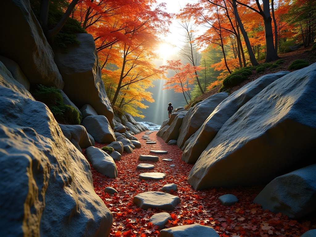
Don't let the gentle name fool you—Thorncrag Bird Sanctuary contains some of Auburn's most technically demanding hiking despite its relatively low elevation. This 450-acre ecological reserve features a network of interconnected trails that can be deceptively challenging, particularly the northern ridge sections.
My engineering background appreciates how the trail system here was designed with natural water management in mind. The elevation changes are subtle (rarely more than 300 feet), but the constant undulation creates a surprisingly intense workout. The Highland Trail Loop (3.2 miles) features my favorite technical section—a quarter-mile stretch of exposed granite that requires careful foot placement and good balance, especially when covered with fallen leaves.
During fall, the sanctuary's diverse tree species create a spectacular color palette that peaks around mid-October. The ridgeline views extend all the way to the White Mountains on clear days. I've found that tracking my routes here can be tricky due to the dense trail network, which is why I always bring my GPS watch to record my explorations and ensure I don't miss any of the hidden viewpoints.
The sanctuary's conservation focus means you'll need to follow strict leave-no-trace principles. Pack out everything you bring in and stick to established trails to protect the fragile ecosystem that makes this place so special.
💡 Pro Tips
- Download the trail map beforehand—cell service is spotty
- The western entrance parking lot fills quickly on weekends
- Bring binoculars—over 150 bird species have been documented here

Lake Auburn Trail System: Elevation with a View
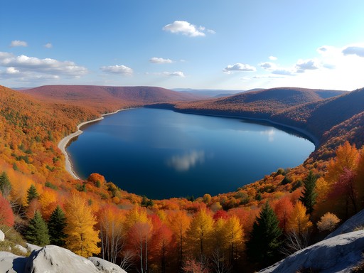
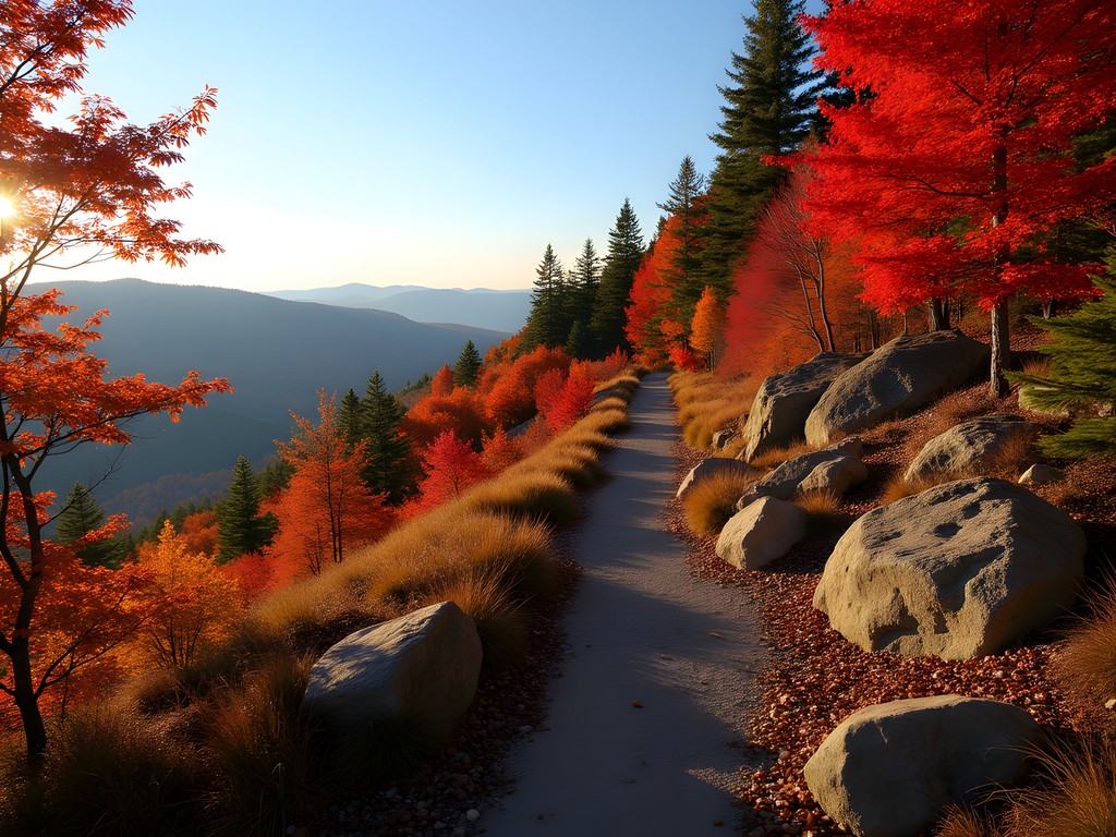
The trail system surrounding Lake Auburn offers what I consider the area's best effort-to-view ratio. While these paths don't reach the technical difficulty of some nearby networks, they compensate with sustained climbs and spectacular vistas of the 2,260-acre lake that serves as Auburn's water supply.
My standard route combines the East Shore Trail (2.4 miles) with the Pinnacle Loop (3.1 miles) for a half-day adventure that delivers consistent elevation gain (about 750 feet total) with several panoramic viewpoints. The northern section features my favorite lunch spot—a natural granite bench overlooking the lake's widest section, perfectly positioned for midday light.
Fall transforms this area dramatically as the lakeside maples and birches create a double spectacle: vibrant colors on the hills reflected perfectly in the protected waters below. I've spent countless hours capturing this phenomenon with my camera, finding new angles with each visit.
The weather here can change rapidly due to the lake effect, especially in autumn. During my last October hike, I experienced three distinct weather patterns in five hours. My packable down jacket has become an essential part of my kit here, providing crucial warmth during unexpected temperature drops while compressing small enough to fit in my daypack when the sun emerges.

💡 Pro Tips
- The northeastern parking area is less crowded but adds 0.8 miles to your hike
- Bring a polarizing filter for your camera to capture the lake reflections
- Respect watershed protection rules—no swimming or off-trail exploration
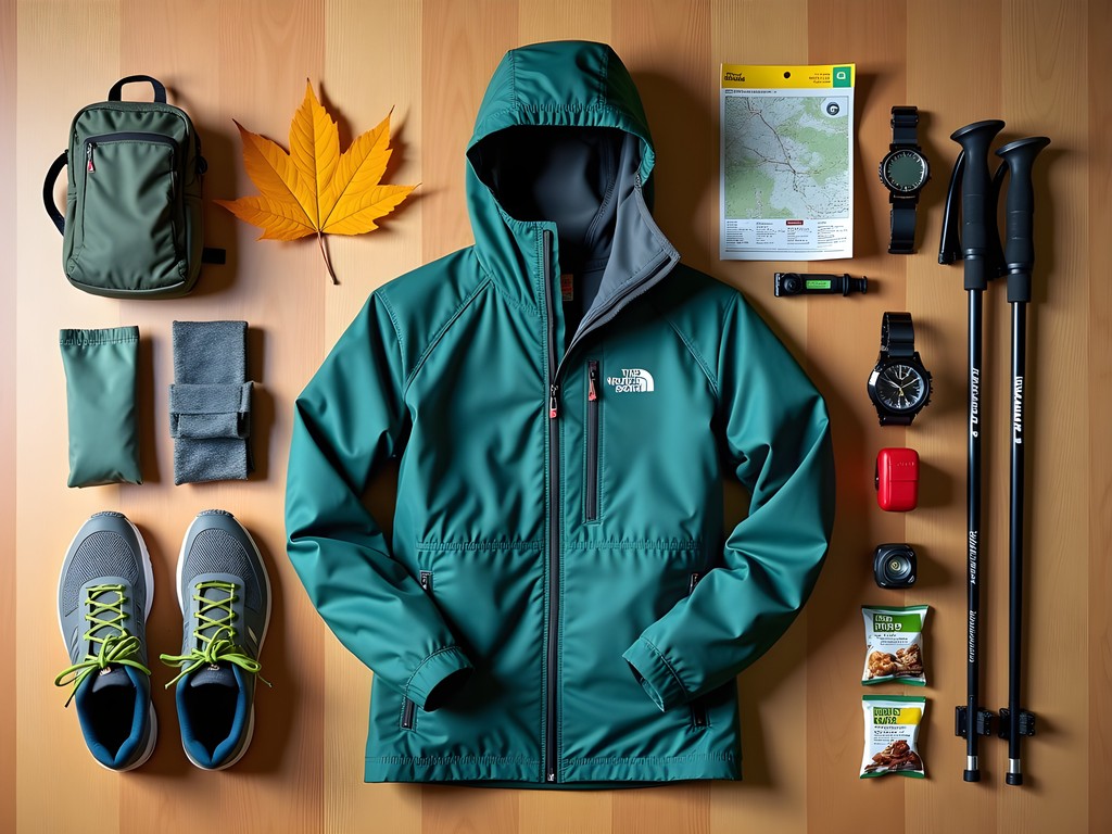
Gear Essentials for Auburn's Varied Terrain
Auburn's trail systems demand versatile gear that can handle rapid weather changes and varying technical challenges. After dozens of hikes in the region across different seasons, I've refined my equipment list to balance weight considerations with preparedness.
Footwear becomes critical on the granite-heavy trails of Thorncrag and Mount Apatite. I've found that my trail runners provide the perfect balance of grip and agility for most conditions, though I switch to more substantial boots after heavy rainfall.
Hydration is another consideration that's easy to underestimate. The humidity levels in Maine's forests mean you'll sweat more than you might expect, even in cooler fall temperatures. I always carry my hydration reservoir filled completely, regardless of planned hike duration. The extra weight is worth avoiding dehydration, especially on the more strenuous Lost Valley circuits.
For navigation, cell coverage is inconsistent throughout the region. While AllTrails and similar apps work well for the more popular routes, I've found myself in dead zones on several occasions. A physical map and compass remain essential backups, particularly in the more remote sections of the Lake Auburn watershed area where trail markings can be sparse.
💡 Pro Tips
- Layering is essential—temperatures can swing 20°F between morning and afternoon
- Apply permethrin to clothing before your trip to prevent tick bites
- Keep a headlamp in your pack even for day hikes—dense forest canopy can make twilight arrive suddenly
Final Thoughts
Auburn's mountain trail systems have taught me that elevation numbers on a map rarely tell the complete story. These trails may not reach the imposing heights of the Rockies or Alps, but their technical challenges, ecological diversity, and spectacular fall scenery create experiences that rival much more celebrated destinations. As an engineer who appreciates both natural systems and thoughtful design, I've found Auburn's network of trails to be masterfully integrated with the landscape—preserving ecological function while providing accessible adventure for hikers across the skill spectrum.
What makes these trails particularly special in autumn is the perfect convergence of comfortable hiking temperatures, minimal crowds (unlike Maine's coastal regions), and a color palette that transforms daily. Whether you're building technical skills on the quarry trails of Mount Apatite or testing your endurance on Lost Valley's full circuit, Auburn offers the rare combination of accessibility and authentic wilderness experience.
As you plan your own weekend adventure, remember that these trails reward the observant hiker—slow down occasionally to notice the geological features, wildlife evidence, and seasonal transformations that make each visit unique. The mountains of Auburn may be hidden gems, but they offer treasures worth discovering for those willing to lace up their boots and explore.
✨ Key Takeaways
- Auburn's trails offer technical challenges despite modest elevations
- Fall provides the optimal combination of weather, colors, and smaller crowds
- The diverse trail systems allow progressive skill building within a small geographic area
📋 Practical Information
Best Time to Visit
Mid-September to late October for peak fall foliage
Budget Estimate
$100-300 for a weekend (accommodation, food, and minimal gear)
Recommended Duration
2-3 days minimum to experience multiple trail systems
Difficulty Level
Easy To Challenging (Trails Available For All Skill Levels)

Comments
Kimberly Murphy
Brian! You've absolutely nailed it with this guide! Just got back from a week exploring Auburn's trails and they're proper hidden gems! The Lake Auburn Trail System was my absolute favorite - those sunrise views over the water were magical. Reminded me of the Lake District back home but with fewer crowds. I'm especially grateful for the skill level breakdown - helped me plan a progressive week starting easy and building up. For anyone heading there, the bird watching at Thorncrag was unexpectedly brilliant - spotted 14 species in just one morning! Has anyone tried these trails in snowshoe season?
dreammaster
Did Lost Valley on snowshoes last February and it was INCREDIBLE! The ski area grooms some connecting trails too, so you can make a whole day of it. Definitely worth a winter trip!
Kimberly Murphy
That sounds brilliant! Adding a winter trip to my list now. Thanks for the tip!
coffeehero
Planning to hit these trails in April - how's the mud season situation in Auburn? Wondering if I should wait until May?
nomadking
April can be hit or miss. Mount Apatite drains pretty well, but Lost Valley can be a mud pit until mid-May. Waterproof boots are a must!
hikerJames52
If you're hitting these trails in summer, don't underestimate the bugs! I did Thorncrag last July and wished I had my insect repellent - the mosquitoes near the wetter sections were fierce. Otherwise, fantastic trails and spot-on descriptions. The bird watching at Thorncrag was incredible - saw three pileated woodpeckers in one afternoon!
smartmate
So true about the bugs! I've found that early morning hikes have fewer mosquitoes than afternoon ones in that area.
Sage Dixon
I hit Auburn last October during peak foliage and it was absolutely stunning - way less crowded than Acadia or the Whites. The Lake Auburn loop became one of my favorite fall hikes in New England. What really struck me was the diversity Brian mentioned - you get that technical scrambling at Thorncrag, the geological treasure hunt at Apatite, and those sweeping water views all within a small area. For anyone planning a trip, I'd budget a full weekend to really experience all four trail systems. The town itself is charming too, found some great local spots for post-hike meals. Maine really does have these hidden gems everywhere once you venture beyond the coast.
Raymond Hassan
Brian, I appreciate your geological insights on Mount Apatite. Having hiked extensively through the Italian Dolomites, I found the mineral formations here surprisingly comparable in diversity, if not scale. The technical sections of Thorncrag reminded me of certain Alpine foothills - deceptively challenging despite modest elevation. I'd suggest visitors consider the seasonal timing carefully; I hiked these in early January and found the ice formations along Lake Auburn Trail added a completely different dimension to the experience. My microspikes were essential for that winter trek. Have you documented the seasonal variations of these trails elsewhere?
Brian Ferrari
Raymond, that's a fascinating comparison to the Dolomites! You're right about the seasonal variations - I'm working on a winter-specific guide that should be up next month. The ice formations along Lake Auburn are truly spectacular.
wanderlusttime7572
Are dogs allowed on these trails?
explorefan
Yes on most but check Thorncrag - I think they have leash requirements during bird nesting season.
backpackace
Pro tip: Lost Valley has a small parking lot that fills up fast on weekends. Get there before 8am or you'll be parking on the road. Also the trail markers aren't great in a couple spots, download the map beforehand.
greengal
Are these trails dog-friendly? Planning a trip with my pup!
coffeehero
I take my lab to Mount Apatite all the time! Just keep them leashed on the main trails. Thorncrag doesn't allow dogs though.
greengal
Perfect, thanks for the info!
dreammaster
Just hiked Lost Valley yesterday and WOW! Those progression trails are exactly what my partner needed to build confidence. Started on the green loops and worked our way up to the blue. The view from the ridge was way better than expected for such a short climb! Definitely bringing our snowshoes back in January.
nomadking
Thanks for highlighting these Auburn trails, Brian! I've hiked all over Maine but somehow missed Mount Apatite until last summer. Those mineral deposits are incredible - my kids found some amazing purple quartz specimens. The trail markers could definitely use some work though. We took a wrong turn and ended up adding an extra mile. Still worth it, but bring a good trail map if you're heading there!
Brian Ferrari
Glad you enjoyed it despite the navigation challenges! You're right about the markers - I should have mentioned that in the post. The Auburn Conservation Commission is actually working on improving the signage this spring.
nomadking
That's great news about the signage update! Will definitely revisit once that's done.
Venture X
Premium card with 2X miles, $300 travel credit, Priority Pass