


Disclosure: This article contains affiliate links. We may earn a commission from purchases at no extra cost to you, which helps our travel content.
Santa Marta sits at a fascinating geographical crossroads where the Caribbean Sea kisses the foothills of Colombia's Sierra Nevada mountains. This juxtaposition creates not just stunning landscapes but a remarkable ecological gradient that has captivated me since my first research expedition here seven years ago. What began as a scientific inquiry into the chemical properties of high-altitude coffee cultivation evolved into a profound connection with this region. Having returned multiple times since, I've systematically explored both the coastal and mountainous terrains, observing how elevation, humidity, and soil composition create distinct microclimates that influence everything from biodiversity to cultural practices. This guide distills my findings into a comprehensive two-week itinerary for advanced outdoor enthusiasts seeking to understand the scientific and cultural tapestry that makes Santa Marta uniquely positioned at the intersection of marine and alpine ecosystems.

The Coastal Laboratory: Tayrona National Park
Tayrona National Park serves as the perfect introduction to Santa Marta's coastal ecosystem—a living laboratory where the Caribbean's warm waters create a unique biochemical environment for marine life. The park encompasses approximately 12,000 hectares of land and 3,000 hectares of marine area, with humidity levels hovering between 70-80% during the dry season.
My recommendation is to allocate three full days to Tayrona. Begin at Cañaveral, where the humid tropical forest meets the shoreline, creating a fascinating ecotone—a transition area between two biomes. Hike the 2-hour trail to Arrecifes, observing how the vegetation adapts to increasing salt exposure. The cellular adaptations in the plant life here are remarkable; many species have developed specialized salt-secreting glands to maintain osmotic balance.
Continue to La Piscina and Cabo San Juan, where you'll find the perfect balance between biodiversity observation and physical exertion. The coral formations here host over 300 species of fish, and the water clarity is exceptional during the dry season, making it ideal for snorkeling. I've spent hours documenting the pigmentation changes in local marine life, which correlate directly with water temperature variations.
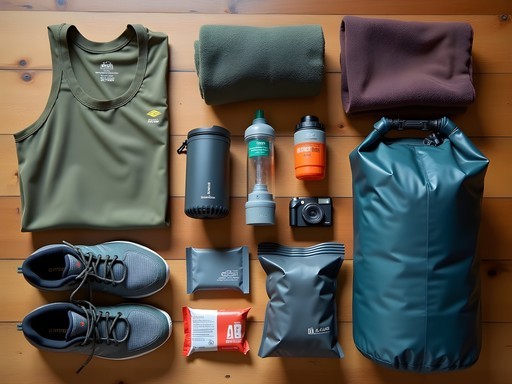
For this coastal exploration, I've found a reliable underwater camera to be invaluable. The ability to document both terrestrial and marine specimens without changing equipment streamlines the experience considerably.
💡 Pro Tips
- Visit Tayrona during weekdays to avoid crowds and better observe wildlife behavior
- The park closes in February for ecological restoration—plan accordingly
- Bring at least 3 liters of water per day as the combination of heat and humidity accelerates dehydration
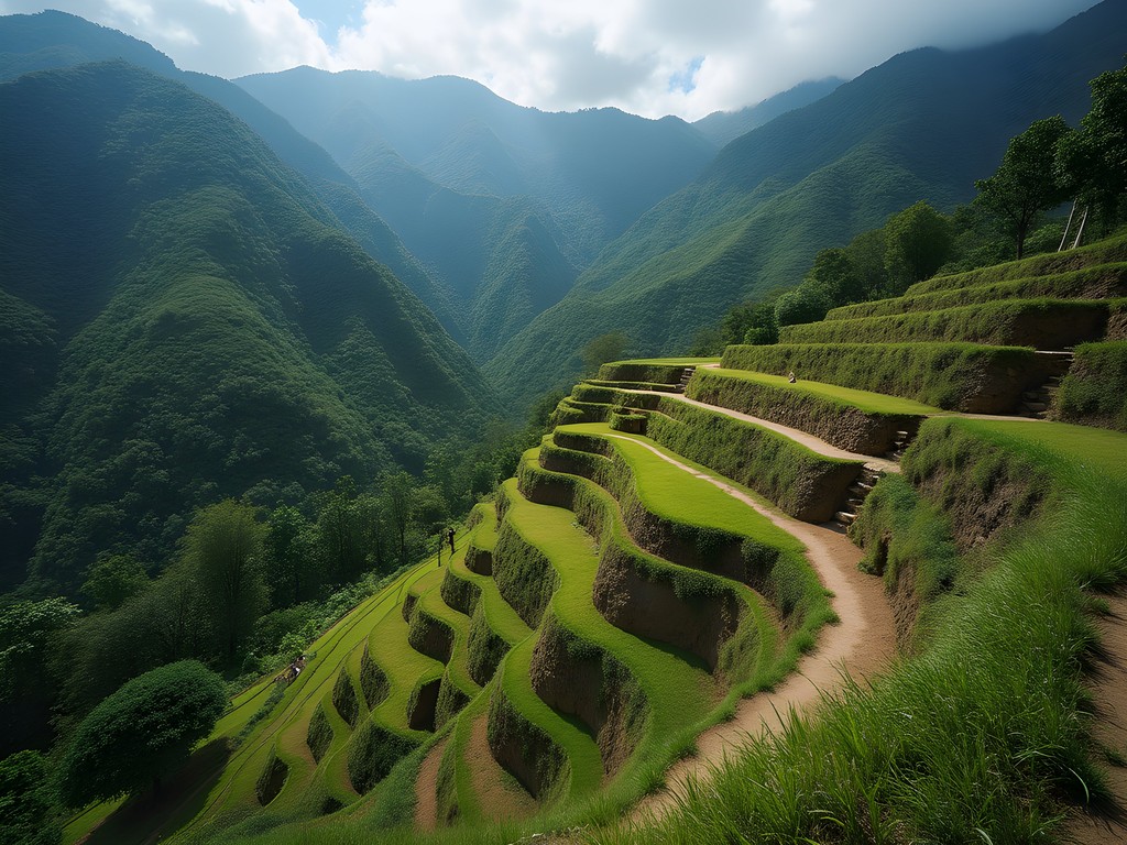
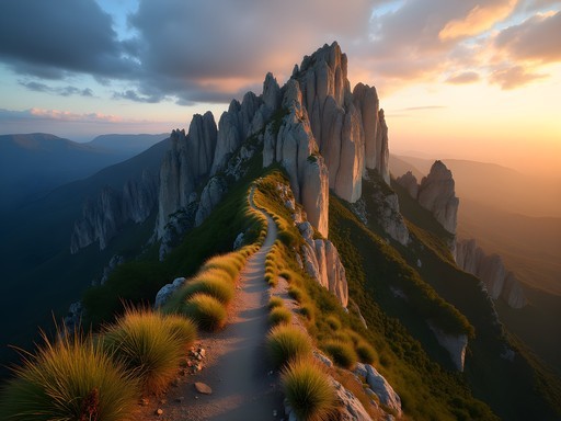
The Vertical Expedition: Sierra Nevada de Santa Marta
The Sierra Nevada de Santa Marta represents one of Earth's most remarkable geographical anomalies—the highest coastal mountain range in the world. This massive formation rises from sea level to 5,700 meters in just 42 kilometers, creating a compressed ecological staircase that would normally stretch across thousands of kilometers. As a chemist, I'm fascinated by how this elevation gradient affects everything from oxygen levels to plant biochemistry.
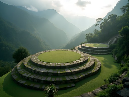
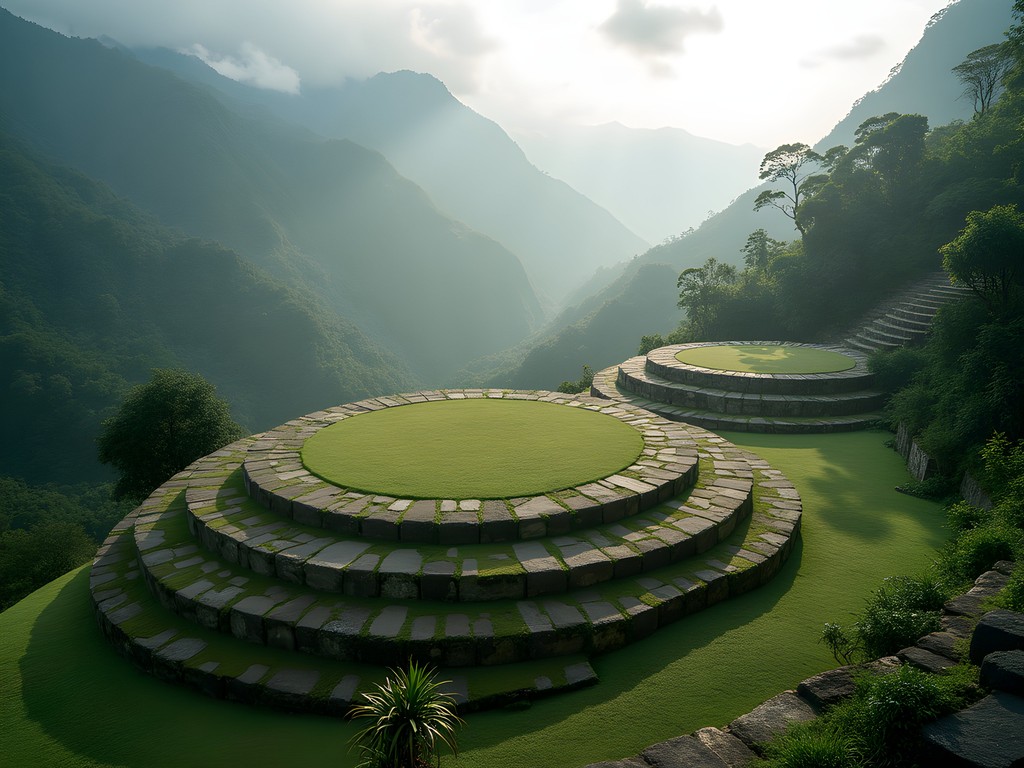
The Lost City (Ciudad Perdida) trek serves as the quintessential multi-day challenge for advanced hikers seeking to understand this vertical ecosystem. This pre-Columbian archaeological site predates Machu Picchu by approximately 650 years, yet remains less frequented due to its demanding access requirements.
The standard route spans 46.6 kilometers round trip with elevation changes of approximately 1,200 meters. While tour operators advertise this as a 4-5 day trek, I recommend the 6-day option for those interested in the scientific and cultural dimensions. The additional time allows for proper acclimatization and more meaningful interactions with indigenous Kogui communities.
What makes this trek scientifically fascinating is observing how the chemical composition of soils changes with elevation, directly influencing agricultural practices. The indigenous Kogui people have empirically developed cultivation techniques that modern agricultural science is only beginning to understand—particularly regarding polyculture systems that maximize nutrient cycling.
For this challenging trek, proper footwear is non-negotiable. I've tested numerous options over multiple expeditions, and my hiking boots have proven ideal for these conditions—providing ankle support on steep descents while remaining breathable enough for the humid lower elevations.
💡 Pro Tips
- Book your Lost City trek with operators who employ indigenous guides for authentic cultural insights
- Pack lightweight, quick-dry clothing as you'll cross the Buritaca River multiple times
- Bring a water purification system as water sources along the trek contain mineral compositions unfamiliar to non-local digestive systems
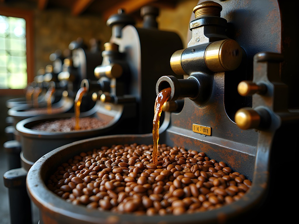
The Coffee Highlands: Minca's Biochemical Treasure
Minca sits at the sweet spot of coffee cultivation—approximately 650 meters above sea level, creating the perfect balance of temperature, humidity, and soil composition for Coffea arabica. As someone who has studied the biochemical processes behind coffee production extensively, I can attest that Minca's microclimate creates unique conditions for developing complex flavor compounds during bean maturation.
Allocate at least three days to this mountain village, using it as a base for exploring the surrounding coffee fincas. La Victoria Coffee Plantation, established in 1892, offers the most comprehensive technical tour of traditional and modern processing methods. What fascinates me is their hybrid water-powered system that combines 19th-century engineering with contemporary quality control practices.
From Minca, ambitious hikers should undertake the full-day trek to El Cerro Kennedy (2,800m). This hike traverses multiple vegetation zones, allowing you to observe how coffee cultivation practices adapt to changing elevations. The higher you climb, the more you'll notice changes in bean density and maturation rates—direct responses to decreased atmospheric pressure and temperature fluctuations.
At dawn from El Cerro Kennedy, you can simultaneously view the Caribbean coastline and the snow-capped peaks of Sierra Nevada—a visual representation of Santa Marta's remarkable ecological compression. This perspective helped crystallize my understanding of how elevation influences chemical processes in plant development.
For coffee enthusiasts wanting to experiment with brewing methods during their stay, I recommend bringing a portable coffee grinder. The ability to adjust grind size allows you to adapt to the varying roast profiles you'll encounter across different elevations.
💡 Pro Tips
- Visit coffee farms in the morning when processing activities are most active
- Bring a small notebook to record tasting notes—the flavor compounds vary noticeably between elevations
- Schedule your El Cerro Kennedy hike to reach the summit before 9 AM when clouds typically obscure the panoramic views

Indigenous Knowledge Systems: Pueblo Wiwa
While many travelers focus exclusively on Santa Marta's natural landscapes, understanding the indigenous knowledge systems provides crucial context for how humans have adapted to this complex environment over millennia. The Wiwa people, one of four indigenous groups inhabiting the Sierra Nevada, have developed sophisticated ecological management practices based on generations of empirical observation.
I recommend dedicating two days to visiting Gotsezhi, a Wiwa settlement accessible via a moderately challenging hike from Minca. Unlike more commercialized indigenous experiences, Gotsezhi offers genuine insight into biocultural conservation practices. What particularly interests me as a scientist is their pharmacological knowledge—their plant classification system recognizes subtle chemical variations that Western botany has only identified through laboratory analysis.
During my visits, I've documented how Wiwa agricultural techniques incorporate understanding of soil microbiomes and plant allelopathy (chemical inhibition between organisms). Their terraced farming systems manage water flow with remarkable efficiency, creating microhabitats that maximize biodiversity within small areas.
Prior to visiting, it's essential to arrange permission through recognized community representatives. This isn't merely a formality but an acknowledgment of indigenous sovereignty over ancestral territories. When properly approached, Wiwa elders often share insights into their cosmological understanding of ecological relationships—connecting observable phenomena with their broader knowledge framework.
For documenting these experiences respectfully, I've found a field notebook invaluable, particularly given the unpredictable humidity conditions that can damage electronic devices. The ability to record observations regardless of weather conditions ensures you can document insights when they occur.
💡 Pro Tips
- Always request permission before photographing people or ceremonial spaces
- Bring appropriate gifts for community hosts—coffee, sugar, and rice are appreciated rather than money
- Learn basic Damana phrases (Wiwa language) as a sign of respect; even simple greetings significantly improve cultural exchange
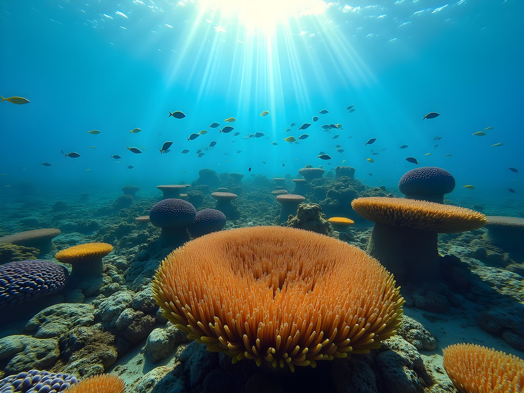
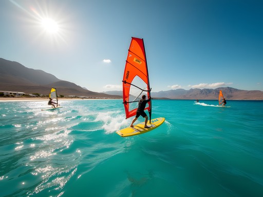
Marine Biodiversity: Taganga and Beyond
After exploring the mountains, return to sea level to investigate the marine ecosystems that make Santa Marta a biodiversity hotspot. The fishing village of Taganga offers access to some of the Caribbean's most diverse underwater environments, with over 1,200 marine species documented in the surrounding waters.
For advanced divers, I recommend a three-day exploration of the underwater ecosystems. Begin with Granate, a dive site featuring underwater caves formed through centuries of wave erosion on calcium carbonate deposits. The chemical interaction between freshwater runoff from the Sierra Nevada and the saline Caribbean creates unique water stratification that supports specialized marine life.
Continue to Isla Aguja, where underwater currents create nutrient upwellings that support exceptional marine biodiversity. During my research dives here, I've observed how seasonal temperature variations affect coral pigmentation—a direct chemical response to environmental stressors that serves as an early warning system for climate change impacts.
For those interested in the intersection of marine biology and human systems, arrange a pre-dawn visit to Taganga's fish market. Here, you'll witness how traditional ecological knowledge guides fishing practices—local fishermen can predict species movements based on subtle water temperature and clarity changes that would require sophisticated instruments for scientific measurement.
The marine portion of your Santa Marta expedition requires specialized equipment. While many items can be rented locally, I've found that bringing my own dive computer ensures more accurate data collection during underwater explorations. The ability to precisely track depth, temperature, and time allows for more systematic observations of how marine ecosystems change across different conditions.
💡 Pro Tips
- Book diving expeditions with operators committed to marine conservation—Poseidon Dive Center has established protocols to minimize ecosystem impact
- Visit Taganga fish market between 5:00-6:30 AM to observe the full spectrum of marine biodiversity being brought in
- Pack reef-safe sunscreen as conventional formulations contain compounds that damage coral molecular structures
Final Thoughts
Santa Marta represents a rare confluence of ecosystems that allows the curious explorer to witness how elevation, temperature, and humidity create distinct environmental conditions within remarkably compressed geography. From the molecular composition of coffee beans at varying altitudes to the chemical adaptations of marine life in coastal waters, this region serves as a living laboratory for understanding ecological relationships. My research expeditions here have consistently revealed how indigenous knowledge systems anticipated scientific discoveries by centuries—particularly regarding sustainable resource management across diverse ecosystems. As climate change accelerates, Santa Marta's compressed ecological gradient may prove invaluable for understanding how species adapt to environmental shifts. I encourage you to approach your journey here not merely as tourism but as an opportunity to document and appreciate the complex interplay between natural systems and human adaptation. The insights you gain in Santa Marta will transform how you perceive ecological relationships worldwide.
✨ Key Takeaways
- Santa Marta's compressed ecological gradient from sea level to 5,700m creates one of Earth's most diverse habitat ranges within minimal geographical distance
- Indigenous knowledge systems contain sophisticated understanding of ecological relationships that complement scientific research
- The region serves as an early indicator system for climate change impacts across multiple ecosystems
- Proper preparation and respect for local customs enhances both safety and depth of experience
📋 Practical Information
Best Time to Visit
December to April (dry season)
Budget Estimate
$1,500-2,500 USD for 2 weeks excluding international flights
Recommended Duration
14-16 days minimum
Difficulty Level
Challenging
Comments
islandbuddy
Quick tip - stay in Taganga instead of Santa Marta centro. It's a small fishing village right next to Tayrona entrance, way more chill vibe and cheaper accommodation. Easy to get everywhere from there.
Jennifer Rodriguez
Agreed! Taganga has great hostel options. We paid like $8/night for a dorm bed with breakfast included.
wanderlustmate
This is EXACTLY what I needed!! Going in March and so pumped now
globelife
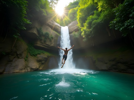
Just got back from Santa Marta two weeks ago and this guide is spot on! The biodiversity is insane - we saw howler monkeys in Tayrona and then hummingbirds in the cloud forest around Minca all in the same day. One thing I'd add is bring good hiking boots. The trails get muddy and slippery, especially in the Sierra Nevada. My trail runners handled it perfectly. Also the waterfalls near Minca (Marinka and Pozo Azul) are worth the trek!
dreamseeker
Love the photos! Adding this to my Colombia itinerary
greenhero210
Did you visit Pueblo Wiwa? I'm really interested in the indigenous knowledge systems part but want to make sure I'm being respectful. How does that work exactly?
Raymond Hassan
You need to arrange visits through authorized community liaisons. They'll explain protocols - typically no photos without permission, dress modestly, and there's usually a small community fee. It's incredibly enriching if done respectfully. The Wiwa are generous with their ecological knowledge.
Jennifer Rodriguez
Great breakdown, Liam! I visited Santa Marta on a tight budget last year and can confirm everything here. Pro tip: skip the expensive tours to Minca and take the colectivo from the market for about 7,000 pesos. The coffee farm tours are reasonably priced once you're there (around 15,000 COP). For Tayrona, camping at Cabo San Juan saves a ton versus the eco-habs. Also, buy your park entry ticket online beforehand to avoid the long queues at the entrance.
wanderlustmate
Super helpful!! Definitely doing the colectivo option
dreamlife
This looks amazing!! How many days would you recommend spending in Santa Marta to do both the beach and mountain stuff?
Raymond Hassan
I'd suggest minimum 5-6 days. Two days for Tayrona, at least one full day in Minca, and a day for the indigenous community visit. The elevation changes are significant so factor in acclimatization time.
dreamlife
Perfect, thanks so much!
islandbuddy
Tayrona was absolutely incredible when we went last year!
greenvibes
OMG those beach-to-mountain views are INSANE!!! 😍 I've never seen a place where you can literally go from snorkeling to mountain hiking in the same day! Is it really possible to do both in one trip? This is exactly what I'm looking for in my first South America adventure!
Liam Matthews
It absolutely is! That's what makes Santa Marta so special. You can snorkel in the morning at Tayrona and be in the coffee highlands by afternoon. Just bring clothes for both climates!
Nicole Russell
Liam, this guide is EXACTLY what I needed when I visited last year! The contrast between the Caribbean beaches and those misty mountain forests is unreal. I spent three days in Minca and it wasn't enough! For anyone planning a trip - don't miss the sunrise from Casa Elemento (that hammock view!). Also, the coffee tour at Finca La Victoria changed how I think about my morning brew forever. One tip I'd add: the public buses to Tayrona can get super crowded. Worth spending a bit extra on the door-to-door shuttle services if you're carrying beach gear. I used my dry bag constantly switching between beach swimming and rainforest hikes with sudden downpours.
sunsetguide
That hammock at Casa Elemento is on my bucket list! Did you stay overnight there or just visit for the day?
Nicole Russell
I stayed one night! It's pretty basic accommodation but THAT VIEW makes it 100% worth it. Book ahead though - it fills up fast in high season!
Venture X
Premium card with 2X miles, $300 travel credit, Priority Pass