


Disclosure: This article contains affiliate links. We may earn a commission from purchases at no extra cost to you, which helps our travel content.
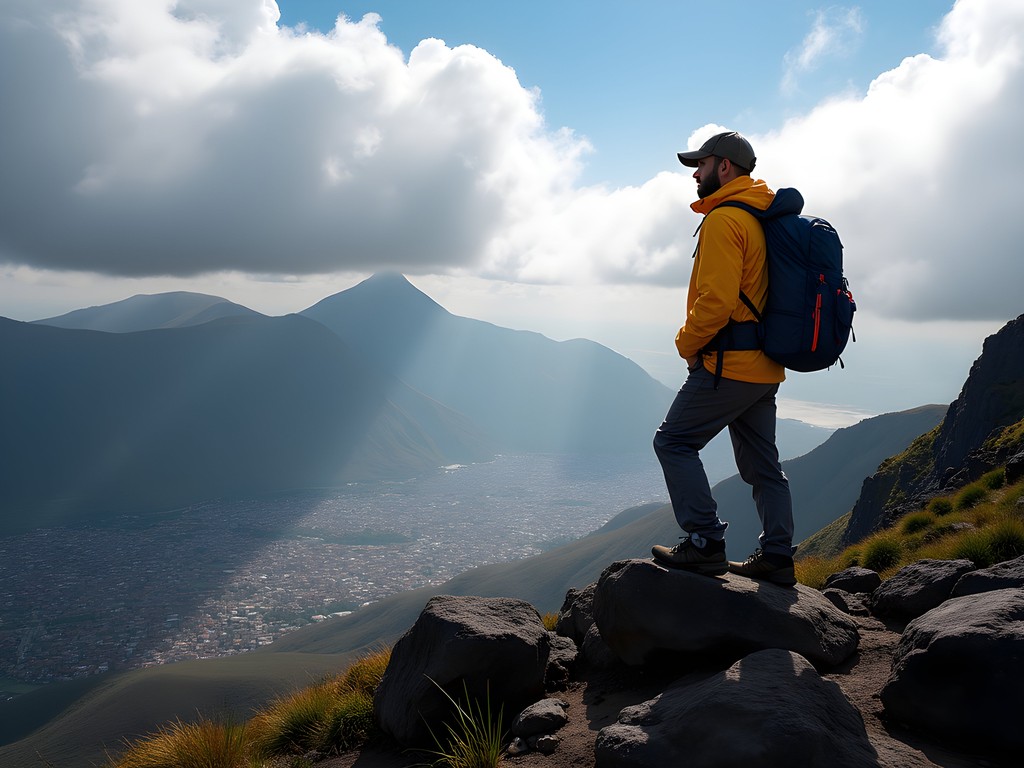
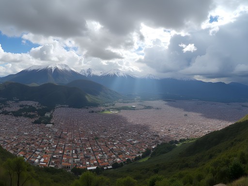
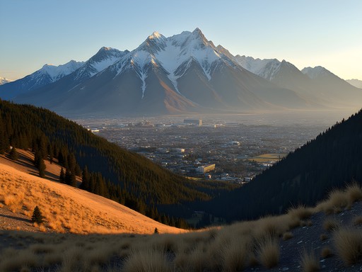
The moment my plane descended toward Quito International Airport, I knew this business trip extension was the right decision. Surrounded by a crown of volcanic peaks and nestled in a high Andean valley at 9,350 feet, Ecuador's capital presents an irresistible challenge for mountain enthusiasts. Having navigated mountain terrain from Colorado to the Swiss Alps, I've developed a particular appreciation for the unique blend of cultural immersion and physical challenge that high-altitude destinations offer. Quito delivers this combination in spectacular fashion. After wrapping up my manufacturing consultation with a local textile company, I dedicated two full weeks to exploring the majestic mountains that define this region. This guide shares my methodical approach to conquering Ecuador's peaks while maximizing both efficiency and authentic experiences – perfect for groups of advanced hikers looking to tackle some of South America's most rewarding terrain during the summer months.

Planning Your Quito Mountain Adventure: Logistics and Preparation
Quito serves as the perfect basecamp for exploring Ecuador's Avenue of the Volcanoes, but proper preparation is non-negotiable at these elevations. I arrived three days before my planned first hike, allowing my body to adjust to the capital's already significant altitude. This acclimatization period is crucial – even for experienced hikers – and I recommend filling it with gentle walking tours of the historic center (a UNESCO World Heritage site) while staying hydrated and avoiding alcohol.
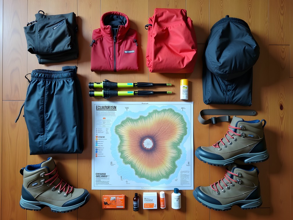
For equipment, I packed strategically knowing I'd face everything from hot equatorial sun to potential snowfall at higher elevations. My layering system proved invaluable as temperatures can swing dramatically between day and night. While certain technical gear can be rented from outfitters in Quito, I never compromise on personal items like properly broken-in hiking boots and my trusty trekking poles, which saved my knees on steep descents.
Accommodation-wise, I split my stay between the historic Hotel Carlota in central Quito (perfect for acclimatization days) and mountain lodges closer to specific hiking destinations. This hybrid approach optimized my time and reduced early-morning transit. For transportation between mountains, I hired a local driver through my hotel for the two-week period – more economical than daily taxis and more flexible than tour groups. However, several reputable tour operators offer excellent guided experiences if you prefer having logistics fully managed.
💡 Pro Tips
- Book accommodations with 24-hour oxygen availability if you're concerned about altitude sickness
- Register your hiking plans with your country's embassy in Quito as a safety precaution
- Download offline maps through apps like AllTrails Pro or Gaia GPS before departure
Acclimatization Hikes: Building Your Altitude Tolerance
A methodical approach to altitude acclimatization isn't just recommended in Ecuador – it's essential for safety and enjoyment. I developed a strategic progression of increasingly challenging day hikes that allowed my body to adapt while experiencing some spectacular terrain.
My journey began with Rucu Pichincha (15,413 ft), accessible via the TelefériQo cable car that whisks you from Quito to 13,000 feet, where the trail begins. This proximity to the city makes it the perfect first serious hike, requiring about 4-5 hours round trip. The path starts deceptively gentle before challenging you with some light scrambling near the summit. The views of Quito sprawling across the valley make every step worthwhile.
Next, I tackled the Pasochoa Ecological Reserve (13,776 ft), about an hour's drive from Quito. This extinct volcano features a well-maintained trail through cloud forest that gradually opens to panoramic views. The biodiversity here is remarkable – I spotted several Andean condors circling above the crater.
For my third acclimatization hike, I ventured to Corazón (15,715 ft), a heart-shaped mountain with a more demanding trail that tests your readiness for bigger challenges. The route traverses páramo ecosystems unique to the northern Andes, with their characteristic frailejones plants creating an almost alien landscape.
These progressive hikes prepared me for the more technical challenges to come while offering diverse ecosystems and cultural encounters along the way. Each evening, I monitored for altitude symptoms and used my pulse oximeter to track my oxygen saturation levels – a small investment that provided valuable data on my acclimatization progress.
💡 Pro Tips
- Follow the 'climb high, sleep low' principle when acclimatizing
- Consider taking Diamox (acetazolamide) after consulting with your doctor before the trip
- Plan rest days between acclimatization hikes to allow your body to adapt
Conquering Cotopaxi: Ecuador's Iconic Volcano
No mountain expedition in Ecuador is complete without attempting Cotopaxi, the world's third-highest active volcano at 19,347 feet. After a week of acclimatization hikes, I felt prepared for this crown jewel of the Ecuadorian Andes. The experience requires advance planning – park permits, guided access, and proper equipment are mandatory.
I arranged a two-day expedition through a reputable local outfitter, beginning with an afternoon drive to the parking area at 14,760 feet. From there, we hiked approximately one hour to the José Rivas Refuge at 15,744 feet. The refuge provides basic but comfortable accommodation with shared bunk rooms and hearty meals – crucial for summit energy.
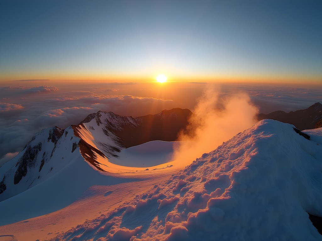
After an early dinner, we attempted a few hours of sleep before the 11 PM wake-up call. Summit day begins in darkness, with headlamps illuminating the path as you traverse snowfields with crampons and ice axes. The predawn climb is strenuous but methodical, with guides setting a pace that balances progress against altitude challenges.
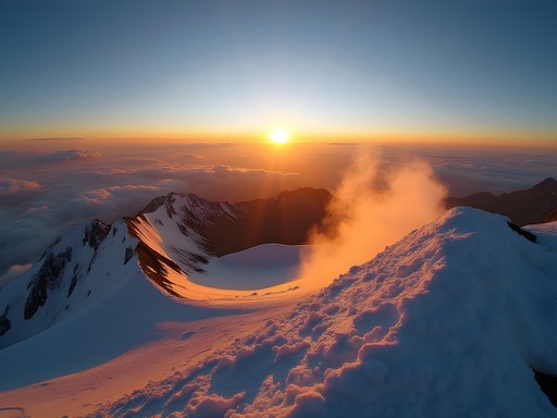
Reaching the crater rim at sunrise was an emotional experience I'll never forget – standing beside a steaming volcanic crater with the Andean landscape unfolding beneath a canvas of orange and pink light. The descent, while physically demanding on different muscle groups, offers spectacular views of the perfect cone shadow Cotopaxi casts across the landscape.
While some tour companies offer one-day express summits, I strongly advise against this approach. The overnight at the refuge significantly increases your summit chances by allowing better acclimatization and the optimal early morning start window. For this expedition, having proper gear is non-negotiable. My insulated mountaineering gloves protected my hands from the biting cold at the summit – a seemingly small detail that made a massive difference in my comfort and safety.
💡 Pro Tips
- Book your Cotopaxi climb at least 2-3 days in advance during peak season
- Request a guide with emergency medical training and experience with altitude issues
- Practice using crampons and ice axe before attempting Cotopaxi if you're new to snow climbing

The Quilotoa Loop: Multi-Day Trekking Through Indigenous Villages
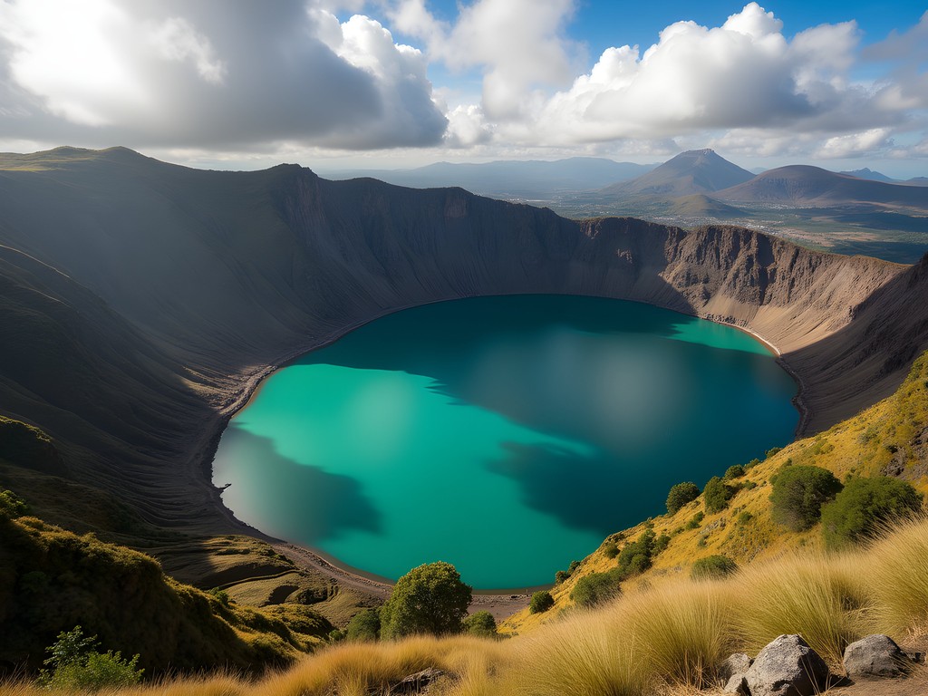
After the high-altitude triumph of Cotopaxi, I shifted focus to a different mountain experience – the culturally rich Quilotoa Loop. This multi-day trek connects indigenous Kichwa villages around the stunning Quilotoa crater lake, offering a perfect blend of physical challenge and cultural immersion.
I opted for the classic 3-day route starting in Sigchos and ending at the crater lake, though you can extend this to 5 days for a more leisurely pace. What makes this trek special is the network of community-based accommodations and family-run hostels along the route, allowing you to experience authentic highland hospitality while supporting local economies.
The terrain varies dramatically day by day – from cloud forest paths to high páramo grasslands, with elevation gains and losses between 500-800 meters daily. While less technically demanding than volcano climbs, the continuous ups and downs through river valleys and mountain passes provide a substantial physical challenge.
Day one took me from Sigchos to Isinlivi, following paths that local farmers have used for generations. The route isn't always well-marked, so I relied heavily on my handheld GPS to navigate confidently. This device also offered peace of mind with its satellite communication capabilities in areas with no cell service.
The second day from Isinlivi to Chugchilán offered the most dramatic landscapes, with the path hugging vertiginous canyon edges before climbing through patchwork agricultural fields. I stayed at the Black Sheep Inn, a sustainable ecolodge that serves exceptional vegetarian meals using ingredients from their organic garden.
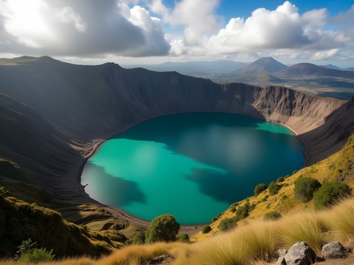
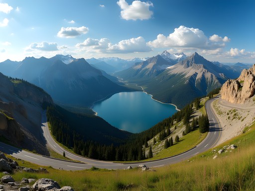
The final day's trek to Lake Quilotoa delivers the grand finale – your first glimpse of the stunning turquoise crater lake surrounded by jagged peaks. The 3-kilometer crater rim hike offers constantly changing perspectives of this geological wonder. While many visitors come directly to Quilotoa by bus for day trips, approaching on foot after days of hiking makes the experience infinitely more rewarding.
💡 Pro Tips
- Book community hostels in advance during high season (June-August)
- Carry small denominations of cash as ATMs are non-existent along the route
- Pack a water filter as clean drinking water isn't always available between villages
Technical Climbs: For the Advanced Mountaineer
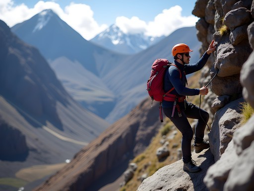
The final phase of my Ecuadorian adventure targeted more technical objectives suitable only for those with previous mountaineering experience. Ecuador offers several challenging peaks that serve as excellent preparation for higher expeditions in the Himalayas or Karakoram, all while being more accessible in terms of logistics and cost.
Iliniza Norte (16,818 ft) presents a challenging class 3-4 scramble with some exposed sections requiring careful route finding. While not requiring technical climbing gear during dry conditions, the rocky terrain demands focus and solid footing. I hired a certified mountain guide for this ascent, which proved invaluable when weather conditions deteriorated unexpectedly near the summit ridge.
For those seeking genuine technical climbing, Iliniza Sur (17,267 ft) provides a more serious glaciated challenge requiring crampons, rope teams, and ice climbing skills. The north face route involves navigating crevasses and climbing 50-60 degree ice – a significant step up in difficulty from its northern neighbor.
The ultimate technical challenge in Ecuador is Chimborazo (20,549 ft), the furthest point from the Earth's center due to the equatorial bulge. While I had initially planned to attempt this giant, honest self-assessment of my acclimatization and energy levels led me to postpone this objective for a future trip. This decision-making process is crucial in mountaineering – knowing when to turn back is as important as knowing how to reach a summit.
For these technical objectives, having appropriate safety equipment is non-negotiable. My climbing helmet protected me from frequent rockfall on Iliniza Norte's loose sections. When preparing for technical mountains, I always prioritize safety gear over comfort items – a principle that has served me well across four continents of mountain adventures.

💡 Pro Tips
- Verify your guide's credentials and experience with technical routes specifically
- Schedule technical climbs for the end of your trip when acclimatization is optimal
- Consider hiring a porter for technical climbs to conserve energy for the summit push
Final Thoughts
Ecuador's mountains offer a remarkable combination of accessibility, technical challenge, and cultural richness that few destinations can match. From the moment you step off the plane in high-altitude Quito to your final summit, this compact Andean nation delivers world-class mountain experiences within a surprisingly manageable two-week itinerary. The key to success lies in methodical acclimatization, respect for the mountains' power, and openness to the cultural contexts that make these peaks more than just physical challenges. Whether you're building mountaineering skills for future Himalayan expeditions or simply seeking to push your hiking abilities to new heights, Quito's surrounding peaks provide the perfect testing ground. As I reluctantly boarded my flight home, I found myself already planning a return trip – next time with Chimborazo firmly in my sights. The mountains of Ecuador may not have the name recognition of the Alps or Rockies, but for the serious mountain enthusiast, they offer some of the most rewarding high-altitude experiences on the planet.
✨ Key Takeaways
- Progressive acclimatization is non-negotiable for safety and summit success in Ecuador's high mountains
- Combining cultural experiences like the Quilotoa Loop with technical climbs creates a more balanced mountain adventure
- Ecuador offers exceptional value for advanced mountaineers seeking high-altitude experience without Himalayan logistics or costs
📋 Practical Information
Best Time to Visit
June through September (dry season)
Budget Estimate
$2,500-4,000 for two weeks excluding international flights
Recommended Duration
Minimum 14 days including acclimatization
Difficulty Level
Advanced - Requires Previous High-Altitude Hiking Experience


Comments
Bryce Diaz
Abigail, loved reading this! The Quilotoa Loop was one of my favorite experiences in South America. I did it solo back in 2022 and stayed in the small family-run hostels along the way. The hospitality was incredible - one family invited me to share dinner with them and we spent the evening talking about life in the highlands. One tip I'd add for your readers: bring small bills. Many of the villages don't have ATMs and the hostels can't always make change for larger notes. Also, the trail markings can be confusing between Isinlivi and Chugchilan, so don't be shy about asking locals for directions. They're always happy to point you the right way.
freeadventurer7744
This looks amazing! Quick question - how bad was the altitude sickness? I'm planning to go in August and kinda worried about that part.
Bryce Diaz
Hey! I spent three weeks in Ecuador last year and altitude was definitely real. Quito sits at 9,350 feet, so you feel it immediately. My advice - take it SUPER slow the first 2-3 days. I made the mistake of trying to hike Rucu Pichincha on day two and felt awful. What worked for me: stayed in Quito for 4 days doing easy walks around the old town, drank coca tea constantly, and avoided alcohol completely. By day 5, I felt much better and could tackle the bigger hikes. Also, if you're doing Cotopaxi, spend at least a week acclimatizing first. The refugio at 15,700 feet is no joke. Listen to your body - headaches and nausea are normal at first, but if it gets worse, descend immediately.
freeadventurer7744
Super helpful, thanks! Gonna add extra days at the beginning then.
Sage Dixon
Your Cotopaxi section brought back intense memories! I summited at dawn in 2024, and that moment when the sun hit the glaciers—I literally stopped breathing. But here's what I wish someone had told me: the glacier crossing is NO JOKE. My crampons kept balling up with snow, and I watched two people from another group turn back at the glacier. I'd invested in decent mountaineering boots before the trip and they made all the difference on that ice. The technical sections are short but genuinely challenging if you're not comfortable with exposure. How did you find the final push to the summit?
Abigail Matthews
The final push was brutal! That scree section at 5,700m had me questioning everything. But yes, proper boots are essential—I saw someone in trail runners struggle badly.
happychamp
Did Quilotoa last year - don't skip the village homestays! Best part of the whole trek
Sage Dixon
100% agree! The homestays are where the magic happens
Jean Wells
Excellent breakdown of the acclimatization process, Abigail. I've analyzed altitude sickness patterns across dozens of high-elevation destinations, and Quito's gradual approach is textbook perfect. One data point worth mentioning: the Quilotoa Loop sits at a consistent 3,800-4,000m, which makes it an ideal intermediate step before Cotopaxi's 5,897m summit. I tracked my own oxygen saturation levels throughout a similar progression and saw marked improvement. Did you notice any correlation between your acclimatization hikes and summit success rate?
Abigail Matthews
Jean, that's fascinating! I didn't track O2 levels systematically, but our guide mentioned that groups doing 4+ acclimatization days had about 85% summit success vs 60% for those rushing it. Wish I'd been more analytical about it!
wanderlustlover
Love the photos!
photowanderer
How long did you spend acclimatizing before attempting Cotopaxi? I've done Kilimanjaro but never hiked at altitude in South America. Is 3-4 days enough or should I plan for more?
Abigail Matthews
Great question! I spent 5 days doing progressively higher acclimatization hikes before Cotopaxi. 3-4 days is the minimum I'd recommend, but everyone responds differently to altitude. Listen to your body!
photowanderer
Thanks! That's really helpful
roamrider
This is amazing!! Adding Quito to my bucket list right now 🏔️
winterninja
Just got back from Ecuador and used this guide extensively - thank you! One thing to add about acclimatization: I found coca tea really helped with mild altitude symptoms. The locals swear by it. Also, the bus system between towns is much better than I expected, though you definitely need to be flexible with schedules!
roamtime
How much Spanish do you need to know for the Quilotoa Loop if you're staying with local families? I only know very basic phrases!
Claire Hawkins
Basic Spanish goes a long way! Most hostels have someone who speaks English, but in villages, simple Spanish phrases and a translation app work well. Learning a few Kichwa greetings impressed locals and made for wonderful connections despite the language barrier. The universal language of smiles works wonders too!
Venture X
Premium card with 2X miles, $300 travel credit, Priority Pass