


Disclosure: This article contains affiliate links. We may earn a commission from purchases at no extra cost to you, which helps our travel content.
Standing beside my rented bicycle at Kinderdijk, watching the morning mist hover over the network of canals and windmills, I couldn't help but think what a perfect classroom this would make. As a geography teacher, I've always believed that landscapes tell stories—and few tell them as eloquently as the Dutch waterways. This intricate system of windmills, dikes, and polders represents humanity's 700-year dance with water management, a physical manifestation of the geographic concept my students often struggle to grasp: how humans adapt to and modify their environment. Over a weekend last summer, I traced this watery narrative by bicycle from the UNESCO-listed windmills of Kinderdijk to the ultramodern skyline of Rotterdam—a journey spanning mere kilometers but centuries of Dutch innovation.

Planning Your Kinderdijk-Rotterdam Cycling Adventure
The beauty of this cycling route lies in its accessibility—even for someone like me who spends most days pointing at maps rather than navigating them in real time. The full journey from Kinderdijk to central Rotterdam spans approximately 23 kilometers (14 miles), making it perfectly manageable as a day trip or, as I preferred, a leisurely weekend exploration with strategic stops along the way.
I began by flying into Amsterdam and taking the train to Rotterdam, then a waterbus to Kinderdijk—a journey that itself offers a primer on Dutch transportation efficiency. While you could bring your own bicycle on international flights (I've done this before when teaching a summer geography course in Copenhagen), renting locally eliminates logistical headaches. I reserved my bike through rental service, which offers reliable city bikes with the signature blue front tire. The Dutch cycling infrastructure makes navigation remarkably straightforward, with dedicated cycle paths (fietspaden) and clear signage throughout the route.
Before setting off, I downloaded the Fietsknoop app, which has become my go-to for cycling navigation in the Netherlands. It allows you to plan routes using the junction-numbering system that forms the backbone of Dutch cycling networks—essentially connecting numbered nodes along dedicated bike paths. I plotted a course that would take me from Kinderdijk through Krimpen aan den IJssel, along the Nieuwe Maas River, and eventually into Rotterdam's center.
💡 Pro Tips
- Book your bicycle at least a week in advance during summer months
- The OV-fiets rental system requires a Dutch bank account, so international visitors should use alternatives like Swapfiets
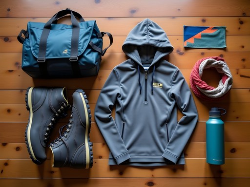
- Consider purchasing a waterproof phone mount for easy navigation while cycling
Day 1: Kinderdijk's Working History
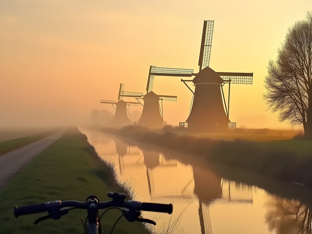
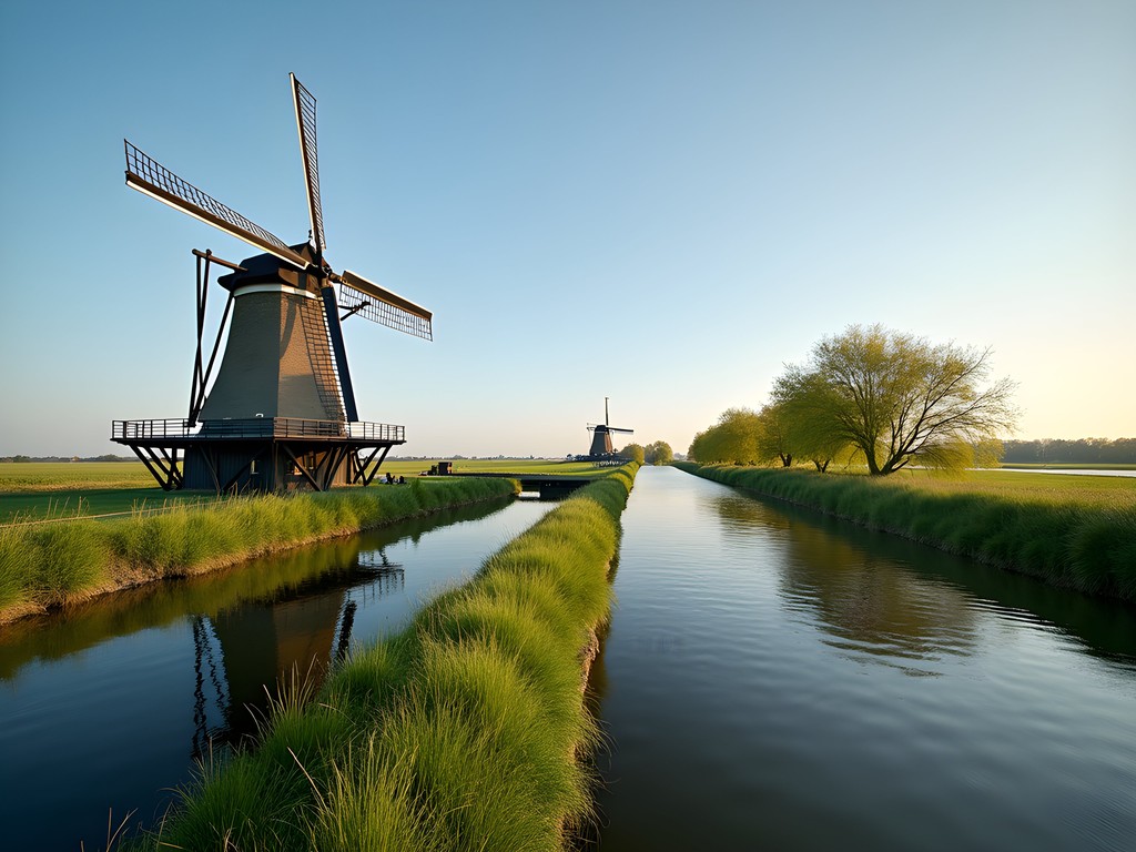
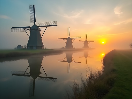
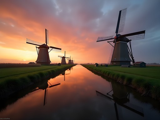
My first day began at the Kinderdijk windmill complex, which opens at 9 am. I deliberately arrived at 8:30 to photograph the windmills before the tour buses descended. As a geography teacher who's shown countless PowerPoint slides of these iconic structures, standing among them felt like meeting celebrities. These 19 windmills, built around 1740, aren't mere historical curiosities or tourist attractions—they represent one of humanity's most ingenious adaptations to challenging geography.
The museum windmill (Nederwaard Museum Mill) offers a fascinating glimpse into the lives of miller families who once lived and worked here. What struck me most was the spatial organization inside—how every square centimeter served multiple purposes in classic Dutch efficiency. My students would recognize this as a perfect example of cultural adaptation to environmental constraints.
I spent about three hours exploring the site, which included a boat tour through the canals. While cycling is restricted within the immediate windmill complex, the surrounding bike paths offer spectacular vantage points. I found a perfect picnic spot along the eastern edge where I could watch the mills while enjoying my packed lunch—a habit formed during years of chaperoning school field trips that I've maintained in my solo travels.
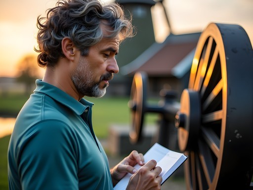
Before departing Kinderdijk, I made sure to visit the visitor center's excellent exhibition on water management. As someone who teaches about human-environment interaction, I was impressed by how they've contextualized these historic structures within contemporary climate challenges. The compact binoculars I always carry came in handy for spotting birds in the wetlands and examining mechanical details of distant windmills.

💡 Pro Tips
- Arrive before 9am to experience Kinderdijk without crowds
- The combined ticket for windmill entry and boat tour offers better value than purchasing separately
- Bring polarizing lens filters for your camera to manage reflections when photographing windmills over water
The River Route: Following the Nieuwe Maas
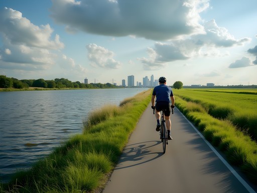
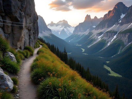
Departing Kinderdijk after lunch, I followed the northern bank of the Nieuwe Maas River toward Rotterdam. This stretch of the journey perfectly illustrates the Dutch concept of ruimte voor de rivier (room for the river)—a water management philosophy that acknowledges rivers need space rather than just higher dikes. As I pedaled along the dedicated bike path, the transition from rural to urban landscapes unfolded gradually but dramatically.
The route took me through Krimpen aan den IJssel, a riverside community where I stopped for coffee at a local café filled with residents rather than tourists. These authentic encounters often provide the richest material for my classroom discussions back in Virginia Beach. The barista, noticing my map and camera, shared stories about growing up in a below-sea-level town and the community's relationship with water—perspectives I could never glean from textbooks.
Continuing westward, the industrial heritage of the region becomes increasingly apparent. Shipyards, warehouses, and port facilities line the riverbanks—a stark contrast to Kinderdijk's pastoral setting but equally important to understanding Dutch geography. I've always found these transitional landscapes particularly fascinating to photograph, where traditional water management practices meet modern industrial needs.
About halfway to Rotterdam, I encountered one of the Netherlands' remarkable cycle bridges, which spiral upward to cross the waterway. My action camera captured the exhilarating descent on the other side—footage that would later elicit gasps from my students when shown alongside our unit on sustainable transportation infrastructure. These purpose-built cycling highways demonstrate how seriously the Dutch take alternative transportation, something I've documented in various cities for my comparative urban mobility research.

💡 Pro Tips
- The riverside route can get windy—plan to cycle into headwinds on your outbound journey when you have more energy
- The Fietsroute LF2 signs (part of the national cycling network) will help guide you along this section
- Waterproof panniers are essential even on sunny days, as afternoon showers are common in summer

Rotterdam: Where Water Meets Innovation
Approaching Rotterdam by bicycle reveals the city's dramatic evolution in a way that arriving by train or car simply cannot match. The skyline gradually materialized before me—a collection of architectural statements that represent Dutch innovation in urban design. As someone who teaches about resilient cities, Rotterdam holds special significance: a city almost completely destroyed during World War II that reinvented itself as a laboratory for forward-thinking urban planning.
I had booked two nights at Hotel Rotterdam, a mid-range accommodation perfectly situated for exploring the city by bike. The hotel offered secure bicycle storage—an essential feature I always look for when traveling with a rental bike. My room overlooked the Nieuwe Maas, providing a visual connection to the route I'd just completed.
Rotterdam's cycling infrastructure seamlessly integrated with the river route, allowing me to navigate directly to the iconic Markthal without dismounting. This remarkable building—a horseshoe-shaped market hall with apartments forming its arch—represents the kind of multifunctional space that makes Dutch urban planning so distinctive. Inside, I wandered among food stalls sampling local specialties while admiring the massive artwork covering the ceiling.
The following day, I dedicated to exploring Rotterdam's relationship with water, from the historic Delfshaven neighborhood (which survived the WWII bombing) to the cutting-edge water plazas—urban spaces designed to temporarily store excess rainwater during heavy storms. The Westersingel Sculpture Route provided a perfect cycling path through the city center, combining art appreciation with practical transportation.
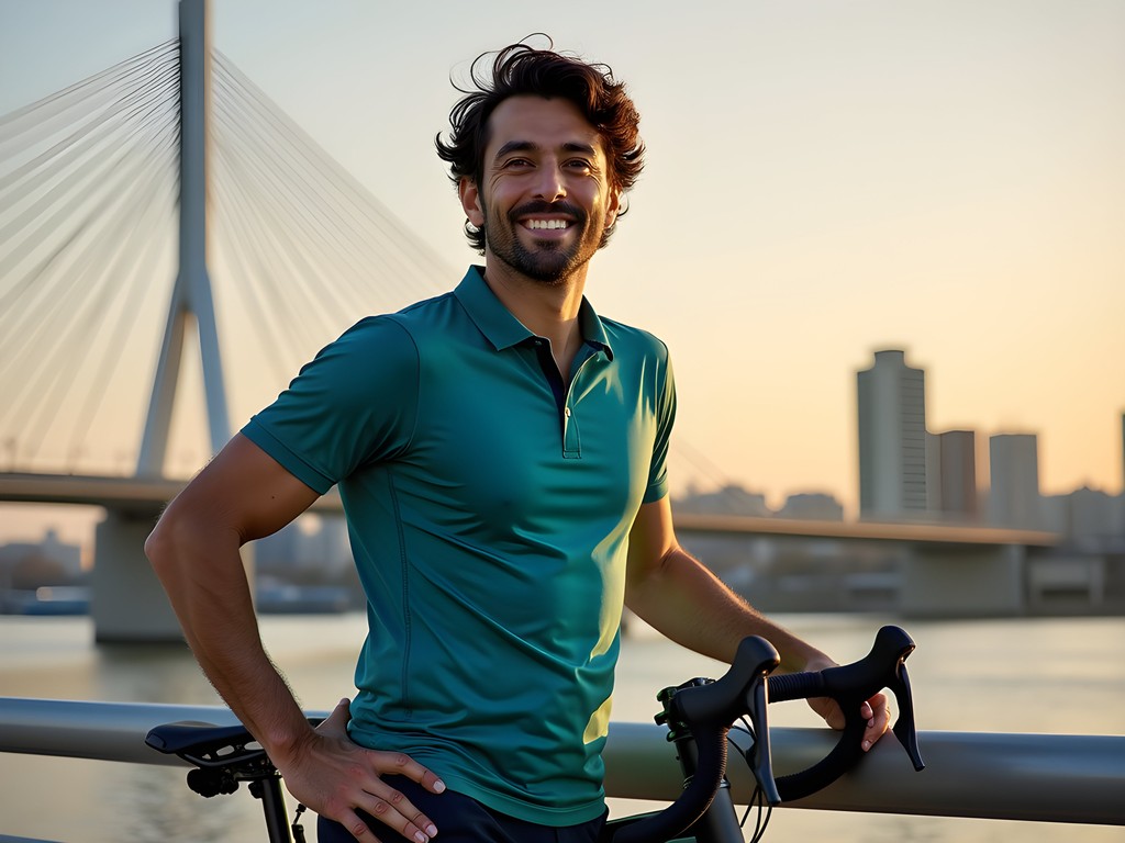
One particularly memorable moment came while cycling across the Erasmusbrug (Erasmus Bridge), locally known as 'The Swan.' I stopped midway to photograph the contrast between Rotterdam's ultramodern buildings and the historic ships in the harbor. My portable tripod proved invaluable for capturing low-light evening shots of the illuminated bridge—images that would later illustrate my lesson on how cities can transform infrastructure into iconic landmarks.
💡 Pro Tips
- Rotterdam's water taxis offer an alternative perspective of the city and can accommodate bicycles
- The Rotterdam Welcome Card includes public transport and museum discounts
- Use the free Regio Rotterdam app for real-time cycling route updates accounting for construction
Connecting Landscapes: The Educational Value of Cycling
As both a geography teacher and travel blogger, I've found few experiences as educationally rich as cycling between Kinderdijk and Rotterdam. This route offers a literal and figurative journey through the evolution of Dutch water management—from traditional windmills to the floating pavilions of Rotterdam's Rijnhaven district. The bicycle, moving at human scale, allows you to observe gradual transitions in landscape that would be missed at higher speeds.
For fellow educators considering this journey, I've developed several field activities that can be adapted for students or your own enrichment. One involves photographing water management features at regular intervals along the route, creating a visual transect from rural to urban approaches. Another examines land use changes visible from the bicycle path, documenting how proximity to Rotterdam influences development patterns.
The route also provides excellent opportunities to practice field sketching—a sadly declining skill in our digital age. I spent an hour at a junction where a modern pumping station stood within view of traditional windmills, sketching both in my waterproof notebook to illustrate technological evolution addressing the same geographic challenge.
What makes this cycling route particularly valuable is its accessibility. With minimal elevation change and excellent path maintenance, it accommodates cyclists of various fitness levels. The clear wayfinding system means you can focus on observing the landscape rather than navigating—though I still recommend having a backup map or GPS device.
For those teaching or studying urban sustainability, the contrast between Kinderdijk's historic approach to environmental challenges and Rotterdam's innovative solutions provides perfect comparative case studies. I've used photographs and experiences from this route to develop lesson plans on climate adaptation, sustainable transportation, and cultural landscapes that consistently engage my high school students back in Virginia.
💡 Pro Tips
- Create a photo journal documenting how water management changes along the route
- Stop at informational panels to learn local perspectives on water management history
- The Rotterdam Library offers excellent reference materials on regional geography if you want to deepen your understanding
Final Thoughts
As I pedaled back to my hotel on my final evening, Rotterdam's lights reflecting on the Nieuwe Maas, I thought about how this relatively short cycling route encapsulates so much of what makes the Netherlands fascinating—the ongoing dialogue between water and land, tradition and innovation, preservation and progress. For solo travelers seeking a weekend adventure that combines physical activity with cultural and educational value, the Kinderdijk to Rotterdam cycle route offers remarkable depth. Whether you're a geography enthusiast like me or simply someone who enjoys exploring landscapes that tell stories, this journey provides a perfect introduction to Dutch water management ingenuity. As I tell my students: geography isn't just something you study—it's something you experience, one pedal stroke at a time.
✨ Key Takeaways
- The 23km route is manageable for intermediate cyclists and offers a comprehensive view of Dutch water management evolution
- Combining Kinderdijk's UNESCO windmills with Rotterdam's innovative architecture provides perfect contrast in a single journey
- Summer offers ideal cycling conditions, but prepare for occasional rain showers even on sunny days
- Allow at least one full day for Kinderdijk exploration and another for Rotterdam's water-related attractions
📋 Practical Information
Best Time to Visit
Late spring through early fall (May-September)
Budget Estimate
$300-400 for a weekend including bike rental, accommodation, and meals
Recommended Duration
2-3 days (1 day at Kinderdijk, 1-2 days in Rotterdam)
Difficulty Level
Intermediate

Comments
summervibes5338
Your photos are stunning! Making me want to book a flight right now!
John Hart
Excellent documentation of this cycling route, Riley. Having cycled extensively throughout the Netherlands over the past decade, I can confirm this is one of the most historically significant routes for understanding Dutch water management. For those planning this journey, I recommend extending your trip to include the Maeslantkering storm surge barrier - a marvel of modern engineering that complements the historical windmills perfectly. It's approximately 20km west of Rotterdam and provides fascinating context on how Dutch water management has evolved from the windmill era to today's high-tech solutions.
journeyvibes
Thanks for this tip! Is the Maeslantkering accessible by bike path?
John Hart
Yes, excellent cycling infrastructure all the way there. Follow the signs toward Hoek van Holland and you'll find it. There's also a visitor center worth exploring.
luckyace
Just did this route last month and it was spectacular! Pro tip: if you're doing this in cooler weather like I did, layers are essential. The wind coming off the water can be pretty intense. I brought my packable windbreaker which was perfect for the changing conditions. Also, don't miss the architecture in Rotterdam - the Cube Houses were mind-blowing and there's a museum apartment you can visit to see how people actually live in them!
greenguy5428
This looks amazing!! Planning to do this in May - do you think one day is enough time or should I plan for two? Also, where did you rent your bike from?
Riley Gonzales
If you want to really explore both Kinderdijk and Rotterdam, I'd recommend two days. I rented from Rotterdam Central Station - they have great quality bikes and the staff helped plan my route.
Lillian Diaz
Riley, this brings back so many memories! I did this exact route last summer but extended it to Gouda (for the cheese, obviously). The bike paths along the waterways are so well-maintained compared to what I'm used to in Jersey City. One tip for anyone planning this trip: download the Fietsknoop app - it's a lifesaver for navigating the Dutch cycling network. Those numbered junction points make it almost impossible to get lost, even for someone directionally challenged like me!
smarthero4853
Those windmills at Kinderdijk are magical! Did you get to go inside any of them?
Riley Gonzales
Yes! Two of them are open to visitors. The one showing how miller families lived in the 1950s was my favorite - so compact but functional!
smarthero4853
That's awesome! Adding that to my list for sure.
skyfan
Great post! Thanks for sharing
wavehero
WOW this is exactly what I've been looking for!! Planning my first solo trip to Europe this fall and wasn't sure where to go but this looks perfect. The windmills are stunning! How many days would you recommend for someone who wants to take it slow and really soak it all in? Also were there good places to eat along the way or should I pack snacks?
skyfan
Pack snacks but plenty of cafes too
travelnomad
Did this last year. Totally worth it!
journeybackpacker5844
This looks amazing!! Adding to my bucket list for sure. Quick question - where did you rent your bike and was it expensive? Also is the route easy to follow or do you need GPS?
travelnomad
Most bike rental places have route maps. Super easy to follow, signs everywhere.
Venture X
Premium card with 2X miles, $300 travel credit, Priority Pass