


Disclosure: This article contains affiliate links. We may earn a commission from purchases at no extra cost to you, which helps our travel content.
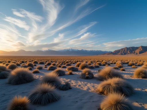
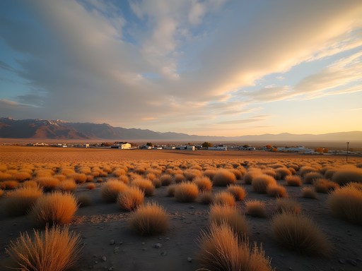
Fernley sits in that sweet spot where the Great Basin Desert brushes up against Nevada's forgotten ranges. Most folks blow past on I-80, headed to Reno or points west. Their loss. I've spent three spring weekends exploring the peaks around this dusty crossroads, and what I found surprised me—accessible summits, zero crowds, and landscapes that shift from sagebrush to alpine in a matter of hours. This is budget adventure territory. No permits. No fees. Just you and the mountain.

Why Fernley Works as Base Camp
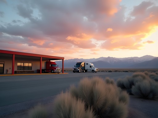
Fernley's not winning beauty contests. It's a working town with truck stops, cheap motels, and that honest, no-nonsense character I appreciate. But location? Perfect.
You're 30 minutes from the Virginia Range, 45 from the Nightingale Mountains, and an hour from the Stillwater Range. Gas is cheaper than Reno. Lodging runs $50-70 a night at the basic chains. The Pilot Travel Center has hot coffee at 5 AM when you need it.
I stayed at the Super 8 for $62 a night—clean, quiet, no frills. Parked right outside my door. Loaded my gear before sunrise without bothering anyone. That's all I need. The mountains don't care where you slept.
Stock up at the Walmart on East Main. Water, snacks, and a decent deli counter for trail sandwiches. I grabbed a insulated water bottle here after my old Nalgene cracked—keeps water cold for the entire climb, which matters when you're ascending through desert scrub in 75-degree spring heat.

💡 Pro Tips
- Fill up on gas in Fernley—stations get sparse once you head into the ranges
- Download offline maps before leaving town; cell service is patchy to nonexistent
- Start climbs by 7 AM to avoid afternoon winds that kick up across the basin
Virginia Range: Desert Peaks for Beginners
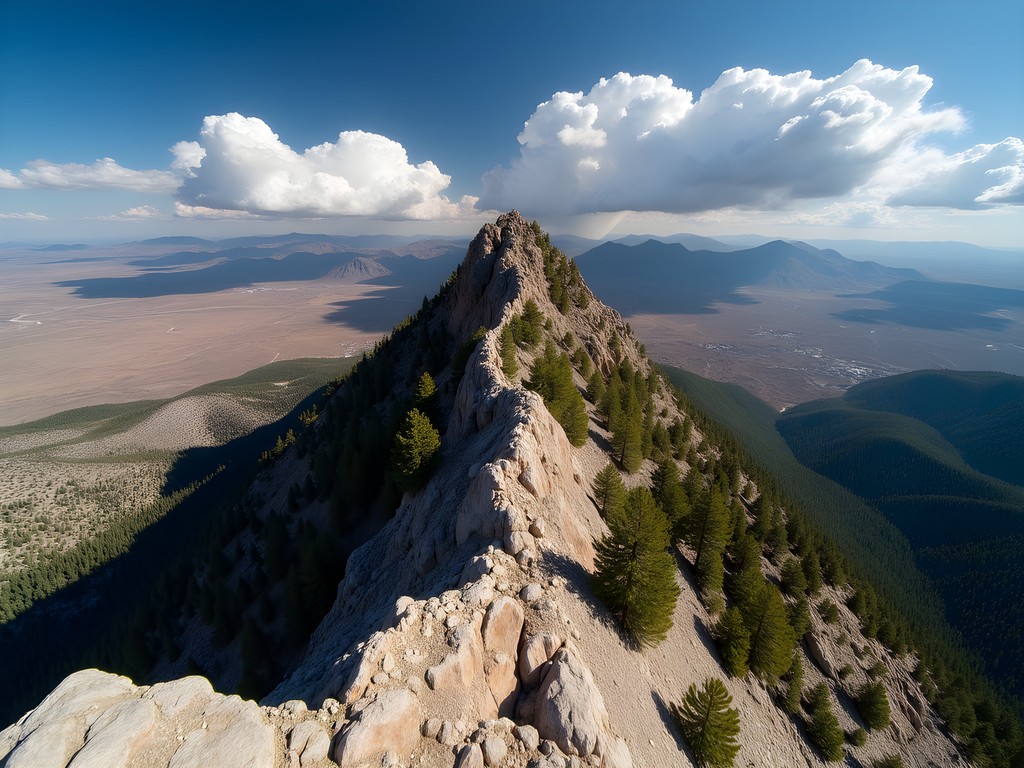
The Virginia Range runs north-south just west of town. These aren't tall peaks—7,000 to 8,000 feet—but they punch above their weight for views.
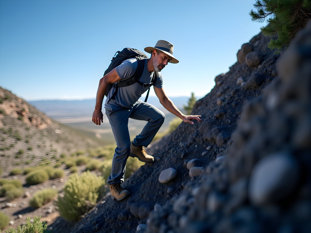
I tackled Bald Mountain (7,846 feet) first. Take USA Parkway north, turn west on any decent dirt road past the industrial park. Navigate by sight. The mountain's obvious. Park where the road gets rough and hike up the ridgeline. Three miles. 1,400 feet of gain. Straightforward scrambling.
The terrain shifts as you climb. Start in rabbitbrush and cheatgrass. Mid-slope brings juniper and scattered pines. The summit? Pure volcanic rock, wind-scoured and honest. Pyramid Lake spreads north like hammered silver. The Stillwater Range rises east. Reno's sprawl looks small and temporary from up here.
I had the mountain to myself. Saw two ravens and a lizard. That's it. The silence up there—it's the kind that makes you think clearly. No trail traffic. No small talk. Just wind and your own breathing.
One note: bring a sun hat with a wide brim. The Nevada sun at altitude doesn't mess around, and there's zero shade once you leave the junipers behind.

💡 Pro Tips
- These peaks are all off-trail navigation—bring a compass and know how to use it
- Rattlesnakes emerge in late spring; watch where you put your hands during scrambles
- Afternoon thunderstorms build fast in April and May; be off summits by 2 PM
Nightingale Mountains: The Lonesome Range
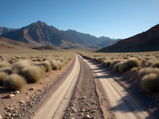
The Nightingales sit northeast of Fernley. Wilder. Rougher access. Worth it.
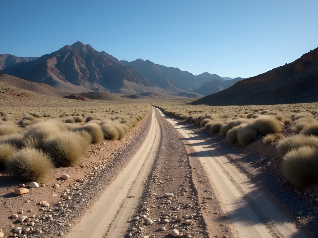
Take Highway 95 north, then head east on Nightingale Road past the geothermal plant. The road deteriorates fast—high clearance recommended, 4WD better. I pushed my rental Subaru farther than I should have. Scraped the undercarriage twice. Learn from my mistakes.
Park where you lose confidence in the road. Pick a peak. Hike up. It's that simple and that hard.
I climbed an unnamed summit—8,013 feet according to my GPS unit—that offered views into the Humboldt Sink. The climb took four hours round trip. Loose scree. Some class 2 scrambling. One short section where I wished I'd brought gloves for the sharp rock.
The solitude here runs deeper than the Virginia Range. No roads visible. No power lines. No jet contrails. Just ancient rock and wind that's been blowing since before humans named these places.
I sat on the summit for an hour. Ate jerky. Drank water. Watched shadows move across the basin. This is why I left Atlanta. Why I started over at 59. These moments of absolute presence.
💡 Pro Tips
- Bring more water than you think—desert air dehydrates faster than you realize
- Mark your vehicle location with GPS coordinates; these mountains all look similar
- Tell someone your plans; this is legitimate backcountry with no cell service

Stillwater Range: The Weekend Challenge
The Stillwaters demand more commitment. Taller peaks—Job Peak hits 8,268 feet—and longer approaches. This is your Saturday adventure, not a half-day jaunt.
Access from the east via Highway 50 and Stillwater Road. The range runs north-south for 50 miles. Pick your peak based on road conditions and ambition. I targeted Chalk Mountain (7,992 feet) from the western approach.
The climb starts in pure desert. Alkali flats. Scattered greasewood. Then you hit the transition zone where Great Basin ecology gets interesting. Mormon tea. Bitterbrush. Suddenly there's a spring—actual running water in this parched landscape. I refilled bottles through my water filter, grateful for the weight savings over carrying everything from the car.
Upper slopes bring limber pine and mountain mahogany. The summit? A knife-edge ridge with exposure on both sides. Wind strong enough to lean into. The entire Lahontan Valley spread below like a map.
This is intermediate terrain. Real navigation required. Real consequences for mistakes. But the rewards match the effort. I saw no one. Found no footprints. Just me and a landscape that remembers when this was all inland sea.
💡 Pro Tips
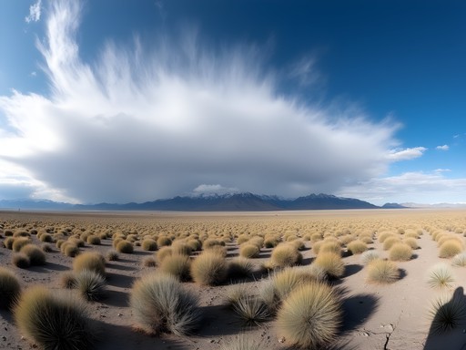
- The Stillwaters generate their own weather; bring a lightweight shell even on clear days
- Spring snowmelt creates temporary water sources—take advantage and lighten your load
- These peaks are best March through May; summer heat makes them brutal
Practical Solo Considerations
These ranges see maybe a dozen visitors a year. That's the appeal and the risk.
I carry a satellite communicator on every climb. Not negotiable. Cell service is fantasy out here. If you break an ankle or encounter a medical emergency, that device is your lifeline. Worth every penny of the subscription cost.
Wildlife is minimal but present. I've seen coyotes, jackrabbits, and plenty of raptors. Rattlesnakes emerge as temperatures warm—April and May especially. Watch your step. Don't put hands where you can't see.
Water is the limiting factor. These aren't the Sierras. Springs are rare and unreliable. I carry three liters minimum, more for longer climbs. Dehydration hits hard at altitude in dry air.
The freedom of solo travel means the responsibility is all yours. Navigation. Safety. Decisions. I prefer it that way. But know your limits. These mountains are forgiving until they're not.
💡 Pro Tips
- Pack a basic first aid kit including blister treatment and elastic bandages
- Bring a headlamp even for day hikes; descents take longer than you expect
- Learn to read Nevada's afternoon cloud patterns—they signal weather changes
Final Thoughts
Fernley won't make anyone's bucket list. These ranges won't trend on Instagram. That's exactly why they matter.
In three weekends, I spent maybe $400 total—gas, lodging, food. I climbed six peaks. Saw three other people. Found the kind of solitude that's becoming rare in our crowded parks and permit-lottery wilderness areas.
These Nevada ranges offer something valuable: accessible adventure without the circus. No reservations. No crowds. No entry fees. Just mountains that don't care about your age, your past, or your Instagram following.
I came to Ireland to reinvent myself at 59. But I keep returning to places like Fernley to remember why reinvention matters. The mountains strip away everything except what's essential. They demand presence. They reward effort. They don't judge.
If you're a solo traveler looking for honest mountain experience on a budget, Fernley's your basecamp. The peaks are waiting. Bring water. Bring navigation skills. Bring respect for the desert. Leave the crowds behind.
✨ Key Takeaways
- Fernley provides cheap lodging and supplies for accessing three distinct mountain ranges within an hour
- These peaks require real navigation skills and self-sufficiency—no trails, no crowds, no safety net
- Spring offers the best conditions: moderate temperatures, possible water sources, and dramatic desert bloom
📋 Practical Information
Best Time to Visit
March through May for optimal temperatures and spring wildflowers; avoid summer heat
Budget Estimate
$300-400 for a weekend including lodging, gas, food, and supplies
Recommended Duration
2-3 days for multiple peaks; single peaks make good day trips from Reno
Difficulty Level
Intermediate—requires Off-Trail Navigation, Scrambling Skills, And Desert Mountain Experience
Comments
Douglas Bradley
Really appreciate this perspective on Nevada's overlooked landscapes. I drove through Fernley twice on my way to Burning Man years ago and never considered it as a destination itself. Your point about the $400 budget is spot-on - we're so conditioned to think adventure travel requires expensive gear and exotic locations. The Nightingale Mountains section particularly caught my attention. How's the road access? I'm assuming high clearance vehicle necessary? Also wondering about seasonal timing - you mentioned spring visits, but would late fall work similarly?
Gary Walker
Late fall is actually ideal - cooler temps, fewer bugs. Road to Nightingale trailhead is rough but I made it in a Subaru. Clearance helps but 4WD not essential if you're careful.
globehero
Going there in March!! Any specific trail in Virginia Range you'd recommend for total beginners?
Gary Walker
The south approach from USA Parkway is easiest. Gentle grade, well-marked. Perfect starter peak.
oceanmood
I did something similar last year in eastern Nevada and you're so right about these forgotten ranges! The solitude is unreal. Did you camp out there or just day trips from Fernley? I'm planning a spring trip and trying to figure out logistics. Also curious about water sources on those Stillwater trails - looks pretty dry from your photos.
Gary Walker
All day trips for this one. Carry ALL your water for Stillwater - absolutely nothing reliable up there. I brought 4 liters for the full day hike.
oceanmood
Perfect, thanks! That's what I figured but good to confirm.
oceanlegend
never even heard of fernley before this!
oceanmood
Right?? That's what makes it so cool. No crowds!
Sophia Gomez
Gary, this is exactly the kind of travel writing we need more of. I'm always chasing the next viral destination for work, but reading this reminded me why I started traveling in the first place. The Stillwater Range sounds incredible - are there any camping spots you'd recommend near the trailheads, or is it better to stick with Fernley motels and drive out each morning? Planning a Nevada swing in April and this just made my itinerary way more interesting.
oceantime
I'd love to know about camping too!
beachwalker
Love this. Nobody writes about Fernley!
oceantime
This looks amazing! How hard are the Virginia Range trails? I'm pretty new to hiking but want to try something different.
beachwalker
Virginia Range is perfect for beginners. Not too steep.
Sophia Gomez
I second that! The Virginia Range is really forgiving. I did a similar desert-to-mountain trip outside Vegas last year and wished I'd known about these spots. The elevation gain is gradual enough that you can focus on enjoying the landscape instead of gasping for air. Just bring way more water than you think you need - desert air is no joke!
Venture X
Premium card with 2X miles, $300 travel credit, Priority Pass